Locations found: 12 named sites across 183 photos
Named only where the pixels, the photographer's filename or GPS support it. 6 photos carry no named site at all, and a further 8 carry a low-confidence name shown as a chip but deliberately kept out of the caption. This pool has very little place evidence in frame: no site signage, and only 162 of 197 frames carry GPS. An honest blank is used rather than a guess. Every derived name is marked "needs check" for you to confirm, and the evidence behind each call is printed under the description.
Open questions for the photographer (1)
Places our curators judged specific and findable but could not name from the pixels or the metadata. Answer one and press the button beside it: the page shows you the sentence it will write, then puts it into every caption in that cluster. Those captions go to Canto on the next sync.
A further 5 questions raised during labeling were answered by GPS or by the photographer's own filename, and are not listed here. Those frames already carry their location.
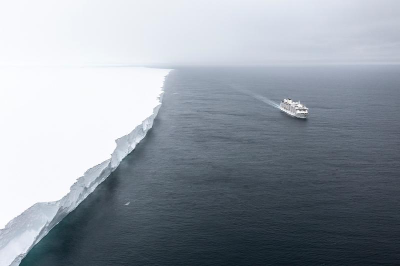
An aerial view along a vertical ice cliff that runs flat to the horizon, with an expedition cruise ship small on the dark water beside it, likely Ross Ice Shelf, the Ross Sea.
✎ This text is the AI Caption. It is the only thing written into Canto.
92Ross Ice Shelf mediumContinuous vertical ice cliff to the horizon with the ship for scale; hero grade · from GPS
Day12_RossIceShelf_RichardSidey-4.jpg
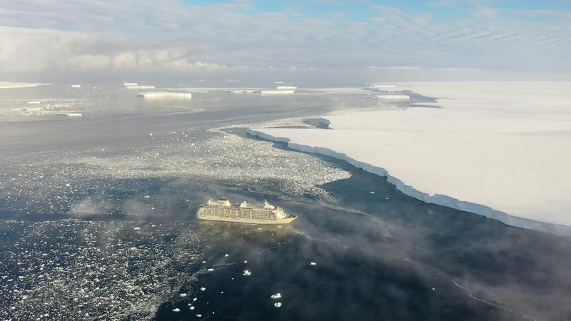
An aerial view of an expedition cruise ship working through brash ice beside a long ice front, with tabular icebergs and low mist beyond, Bartlett Inlet, Ross Ice Shelf, the Ross Sea.
✎ This text is the AI Caption. It is the only thing written into Canto.
91Bartlett Inlet, Ross Ice Shelf highDrone wide with warm light, mist and tabular bergs; ship gives the ice front scale
Day14_BartlettInlet_RichardSidey-33.jpg
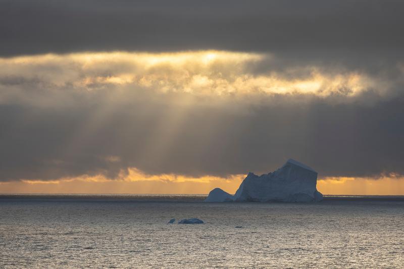
Sunbeams break through a heavy cloud bank onto a large iceberg standing alone on a dark sea, Phantom Coast, Marie Byrd Land, the Ross Sea.
✎ This text is the AI Caption. It is the only thing written into Canto.
91Phantom Coast, Marie Byrd Land highCrepuscular light on a lone berg; the strongest weather frame in the batch · from GPS
Day15-22_PhantomCoast_RichardSidey-11.jpg
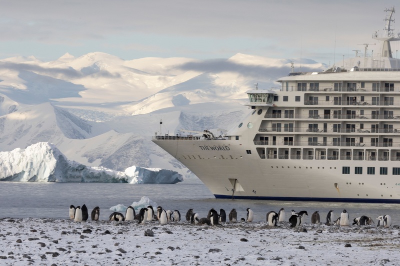
A line of Adelie penguins stands on a snow-dusted beach while MS The World lies at anchor close inshore below glaciated mountains, Cape Adare, the Ross Sea.
✎ This text is the AI Caption. It is the only thing written into Canto.
90Cape Adare highBow name THE WORLD is the vessel, not a place; ship, penguins and peaks together
Day8_CapeAdare_RichardSidey-6.jpg
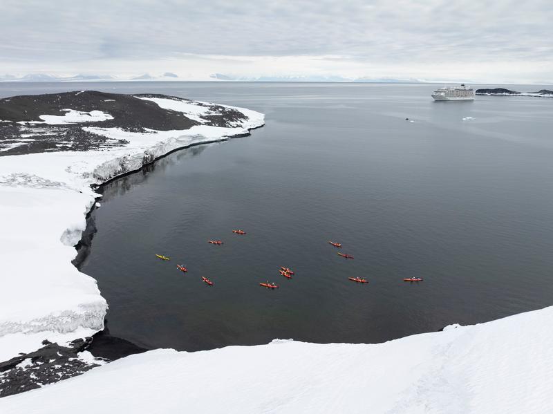
A dozen sea kayaks spread across a dark sheltered bay below a snow slope while the ship lies offshore and a mountain range stands on the horizon, Cape Royds, the Ross Sea.
✎ This text is the AI Caption. It is the only thing written into Canto.
90Cape Royds highKayaks, ship and far range in one elevated frame; big scale, clean composition · from GPS
Day10_CapeRoyds_RichardSidey-23.jpg
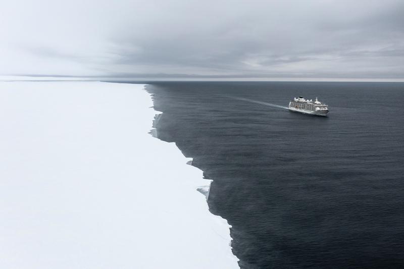
An expedition cruise ship steams along the edge of a flat ice sheet that runs unbroken to the horizon, dark open water on one side and white ice on the other, likely Ross Ice Shelf, the Ross Sea.
✎ This text is the AI Caption. It is the only thing written into Canto.
90Ross Ice Shelf mediumShip tiny against an ice edge to the horizon; strong scale juxtaposition · from GPS
Day12_RossIceShelf_RichardSidey-3.jpg
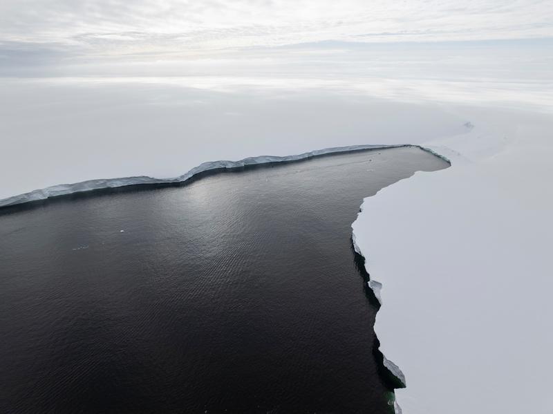
An aerial view of a long ice shelf edge where a channel of black water cuts between two flat white ice plains running to the horizon, Bartlett Inlet, Ross Ice Shelf, the Ross Sea.
✎ This text is the AI Caption. It is the only thing written into Canto.
90Bartlett Inlet, Ross Ice Shelf highGraphic aerial of a flat ice front; the shape is the whole picture · from GPS
Day14_BartlettInlet_RichardSidey-36.jpg
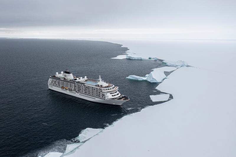
An aerial view of an expedition cruise ship lying against the broken edge of a vast flat ice plain, with floes calving off along the line, Bay of Whales, Ross Ice Shelf, the Ross Sea.
✎ This text is the AI Caption. It is the only thing written into Canto.
90Bay of Whales, Ross Ice Shelf highClean drone wide, ship at full length, ice edge running to the horizon · from GPS
Day13_BayOfWhales_RichardSidey-30.jpg
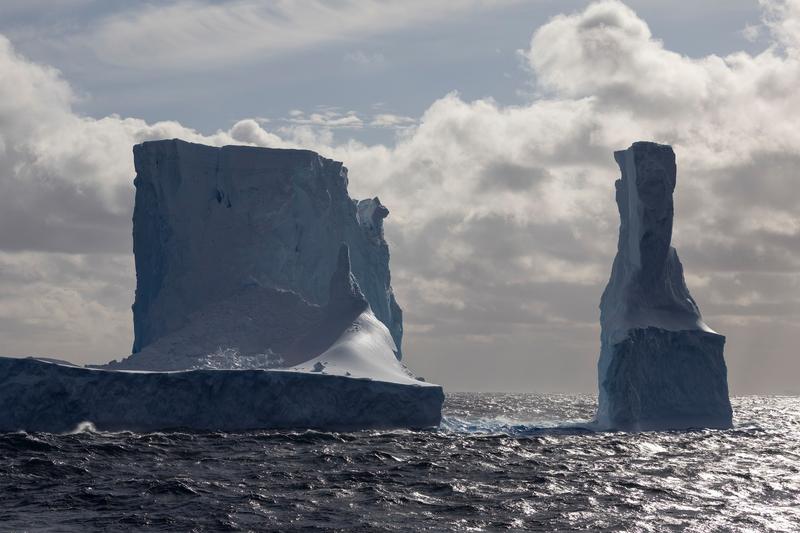
A huge twin-towered iceberg catches side light beneath towering cumulus, its tabular apron running out across the water, Phantom Coast, Marie Byrd Land, the Ross Sea.
✎ This text is the AI Caption. It is the only thing written into Canto.
90Phantom Coast, Marie Byrd Land highBest light and cloud on the twin-tower berg; brochure opener quality
Day15-22_PhantomCoast_RichardSidey-92.jpg
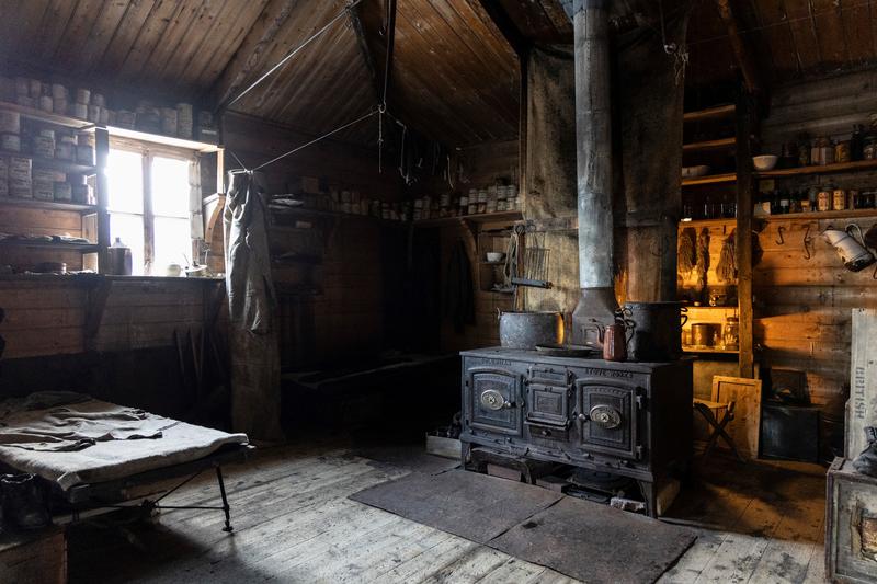
Window light falls across a preserved hut interior with a cast iron range and blackened pots, a canvas bunk, and shelves of tins and bottles on the timber walls, Cape Royds, the Ross Sea.
✎ This text is the AI Caption. It is the only thing written into Canto.
89Cape Royds highBest-lit interior of the batch; stove lettering is a brand, not a place · from GPS
Day10_CapeRoyds_RichardSidey-10.jpg
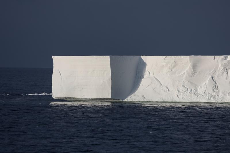
A tabular iceberg with sheer square-cut walls stands brilliantly lit against a near-black sky over dark sea, likely Bartlett Inlet, Ross Ice Shelf, the Ross Sea.
✎ This text is the AI Caption. It is the only thing written into Canto.
89Bartlett Inlet, Ross Ice Shelf mediumStrong tonal separation, clean geometry, classic tabular berg of the far south · from GPS
Day14_BartlettInlet_RichardSidey-4.jpg
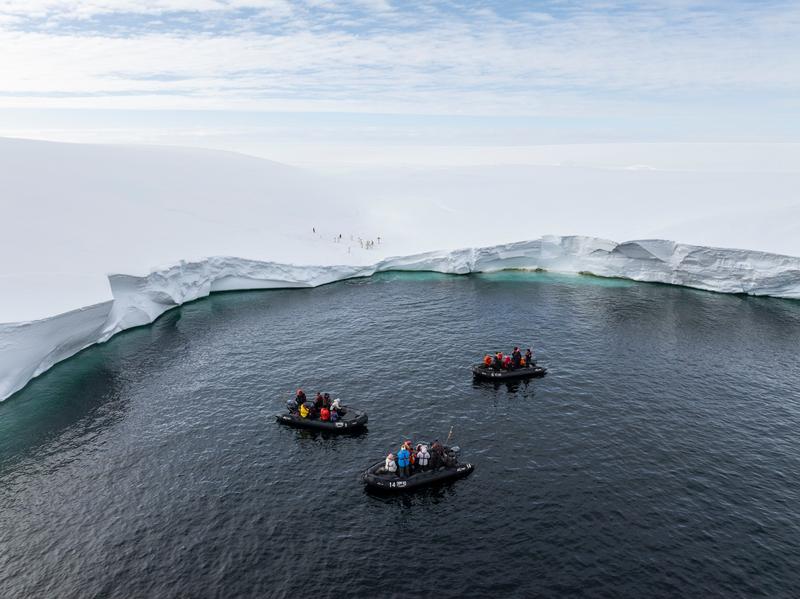
An aerial view of three zodiacs in a pool of dark water enclosed by the curving edge of an ice shelf, with penguins on the snow above, Bartlett Inlet, Ross Ice Shelf, the Ross Sea.
✎ This text is the AI Caption. It is the only thing written into Canto.
89Bartlett Inlet, Ross Ice Shelf highAerial with green underwater ice ledge and boats for scale; strongest of this sequence · from GPS
Day14_BartlettInlet_RichardSidey-34.jpg
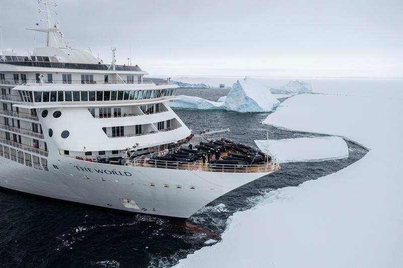
An expedition cruise ship noses its bow into fast ice with stacked zodiacs on the foredeck and icebergs frozen into the plain beyond, Bay of Whales, Ross Ice Shelf, the Ross Sea.
✎ This text is the AI Caption. It is the only thing written into Canto.
89Bay of Whales, Ross Ice Shelf highShows the ship working ice with its tender fleet; bow name is the vessel · from GPS
Day13_BayOfWhales_RichardSidey-33.jpg
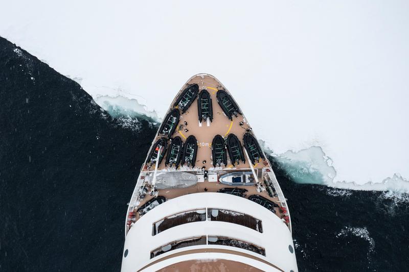
An overhead aerial of MS The World's bow, rows of zodiacs stowed on the foredeck, pushing into the edge of the fast ice, Bay of Whales, Ross Ice Shelf, the Ross Sea.
✎ This text is the AI Caption. It is the only thing written into Canto.
89Bay of Whales, Ross Ice Shelf highTop-down bow and zodiac rows against the ice edge; strong graphic scale · from GPS
Day13_BayOfWhales_RichardSidey-34.jpg
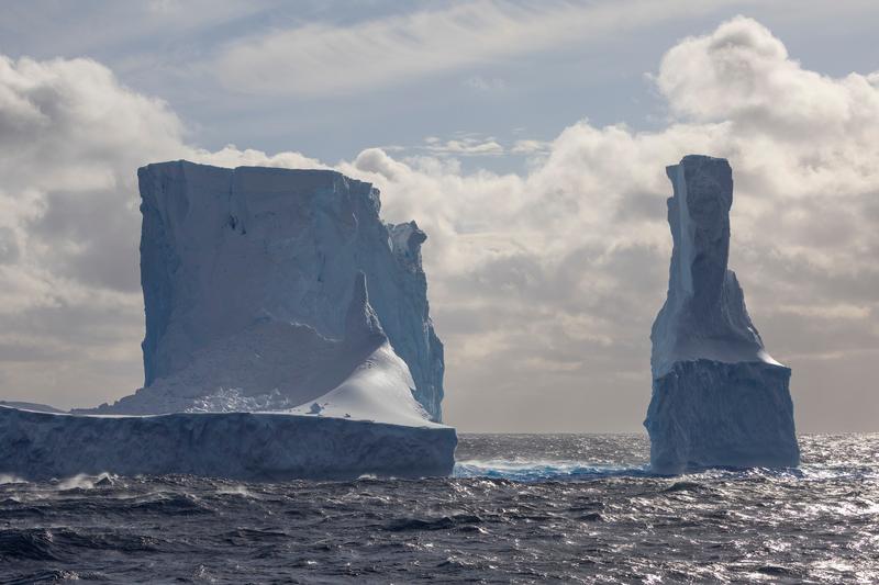
A twin-towered iceberg under piled cumulus, one block square-cut and the other a leaning column, joined by a low ice apron, Phantom Coast, Marie Byrd Land, the Ross Sea.
✎ This text is the AI Caption. It is the only thing written into Canto.
89Phantom Coast, Marie Byrd Land highTwo towers separated cleanly against cloud; the most graphic angle of this berg
Day15-22_PhantomCoast_RichardSidey-93.jpg
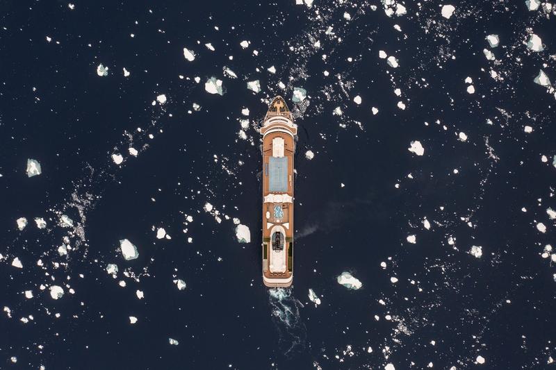
A top-down aerial shows MS The World steaming between scattered white floes on deep blue water, likely Ross Sea, on passage, the Ross Sea.
✎ This text is the AI Caption. It is the only thing written into Canto.
88Ross Sea, on passage mediumGraphic straight-down composition, whole vessel in frame, rich contrast · from GPS
Day7_AtSea_RichardSidey-13.jpg
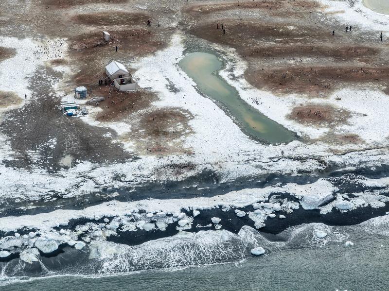
An aerial view of a low gravel spit holding a preserved timber hut, a store shed and a meltwater pond, with thousands of Adelie penguins spread across the bare ground, likely Cape Adare, the Ross Sea.
✎ This text is the AI Caption. It is the only thing written into Canto.
88Cape Adare mediumHistoric huts inside a very large Adelie colony on a flat spit fits Cape Adare
Day8_CapeAdare_RichardSidey-13.jpg
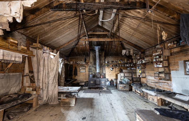
The interior of a preserved expedition hut, with a cast iron stove and flue at the centre, bunks under canvas, and shelves of tins, bottles and stencilled provision crates along the timber walls, Cape Royds, the Ross Sea.
✎ This text is the AI Caption. It is the only thing written into Canto.
88Cape Royds highSingle-room hut with original contents; which hut is not readable from pixels · from GPS
Day10_CapeRoyds_RichardSidey-4.jpg
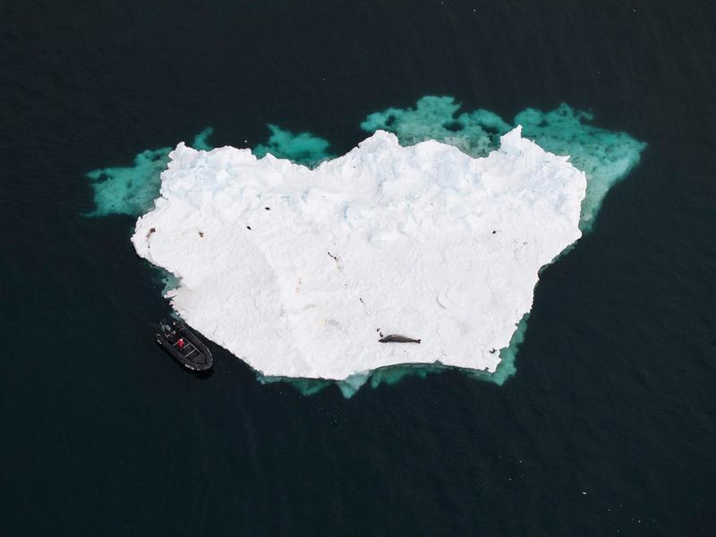
A top-down aerial shows a zodiac holding position at the edge of a large white floe where a seal lies hauled out, the submerged ice glowing turquoise, Cape Royds, the Ross Sea.
✎ This text is the AI Caption. It is the only thing written into Canto.
88Cape Royds highGraphic straight-down frame, boat gives scale to the floe and the seal · from GPS
Day10_CapeRoyds_RichardSidey-21.jpg
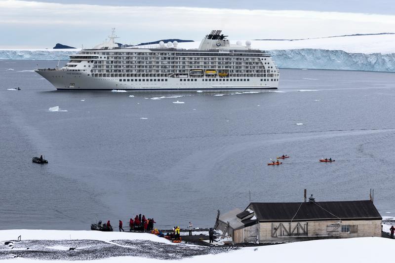
MS The World lies at anchor off a black shore with a long ice cliff running behind her, kayakers and a zodiac working the bay and a large timber hut standing above the landing beach, Cape Evans, the Ross Sea.
✎ This text is the AI Caption. It is the only thing written into Canto.
88Cape Evans highTHE WORLD is the vessel name; ship, hut, kayaks and ice cliff together · from GPS
Day11_CapeEvans_RichardSidey-7.jpg
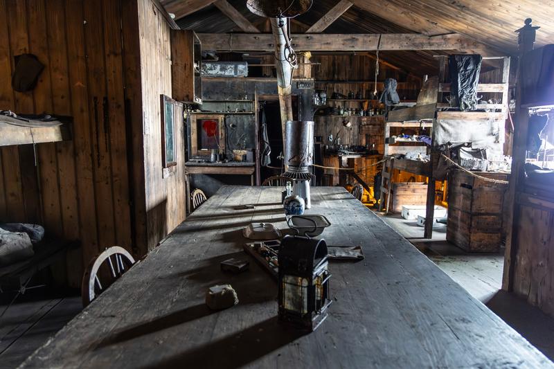
A long plank mess table with a lantern on it runs down the middle of a large preserved hut, bunks and a stove flue behind it under the timber roof, Cape Evans, the Ross Sea.
✎ This text is the AI Caption. It is the only thing written into Canto.
88Cape Evans highBigger hut than the stove-room interior; deep receding table, rich detail · from GPS
Day11_CapeEvans_RichardSidey-5.jpg
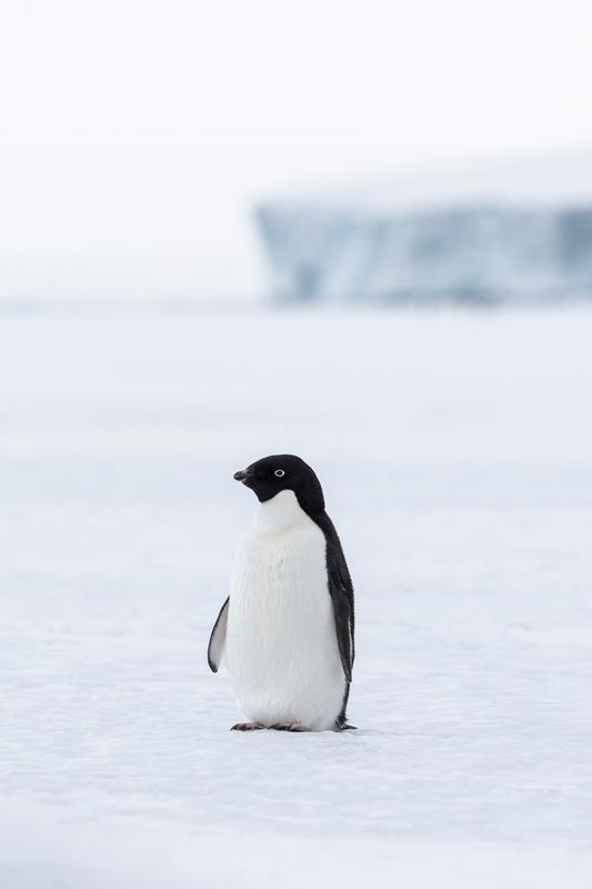
A single Adelie penguin stands on flat sea ice with a tabular iceberg in the pale haze behind it, Cape Evans, the Ross Sea.
✎ This text is the AI Caption. It is the only thing written into Canto.
88Cape Evans highWhite eye ring and all-black head confirm Adelie; clean minimal high-key frame · from GPS
Day11_CapeEvans_RichardSidey-10.jpg
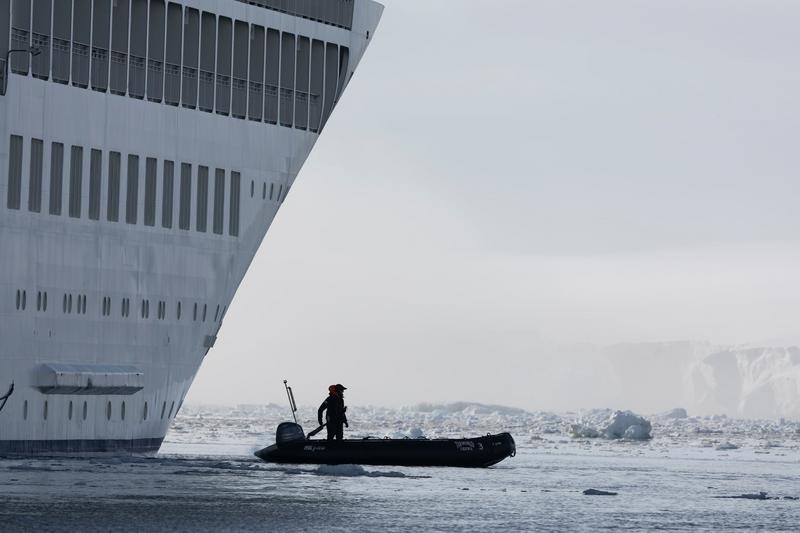
A crew member drives an empty zodiac past the towering bow of an expedition cruise ship through brash ice, with an ice cliff faint in the haze beyond, Bartlett Inlet, Ross Ice Shelf, the Ross Sea.
✎ This text is the AI Caption. It is the only thing written into Canto.
88Bartlett Inlet, Ross Ice Shelf highOne figure against a huge hull and distant ice cliff; scale juxtaposition Carson favours · from GPS
Day14_BartlettInlet_RichardSidey-6.jpg
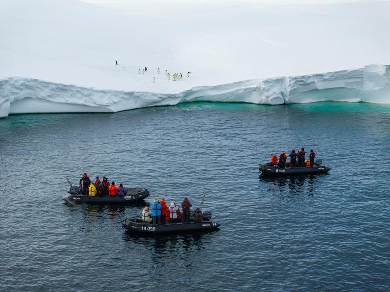
Three zodiacs of passengers hold position on turquoise-fringed water below a low ice cliff, with emperor penguins standing on the snow plain above them, Bartlett Inlet, Ross Ice Shelf, the Ross Sea.
✎ This text is the AI Caption. It is the only thing written into Canto.
88Bartlett Inlet, Ross Ice Shelf highHigh angle, boats small under the ice edge, penguins above; whole story in one frame · from GPS
Day14_BartlettInlet_RichardSidey-35.jpg
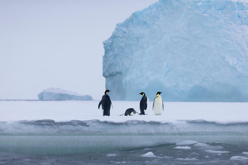
Four emperor penguins stand on the edge of a floe, one lying flat among them, with a tall blue iceberg behind and a smaller berg on the horizon, Bay of Whales, Ross Ice Shelf, the Ross Sea.
✎ This text is the AI Caption. It is the only thing written into Canto.
88Bay of Whales, Ross Ice Shelf highAnimals in a full scene with the berg for scale; the layered look Carson prefers · from GPS
Day13_BayOfWhales_RichardSidey-21.jpg
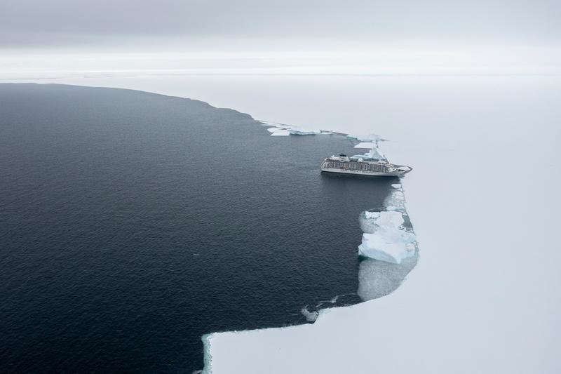
An aerial view of an expedition cruise ship far off along a curving ice edge, dark water filling half the frame and white ice the other, Bay of Whales, Ross Ice Shelf, the Ross Sea.
✎ This text is the AI Caption. It is the only thing written into Canto.
88Bay of Whales, Ross Ice Shelf highShip reduced to a speck against the ice edge; the scale contrast carries it · from GPS
Day13_BayOfWhales_RichardSidey-31.jpg
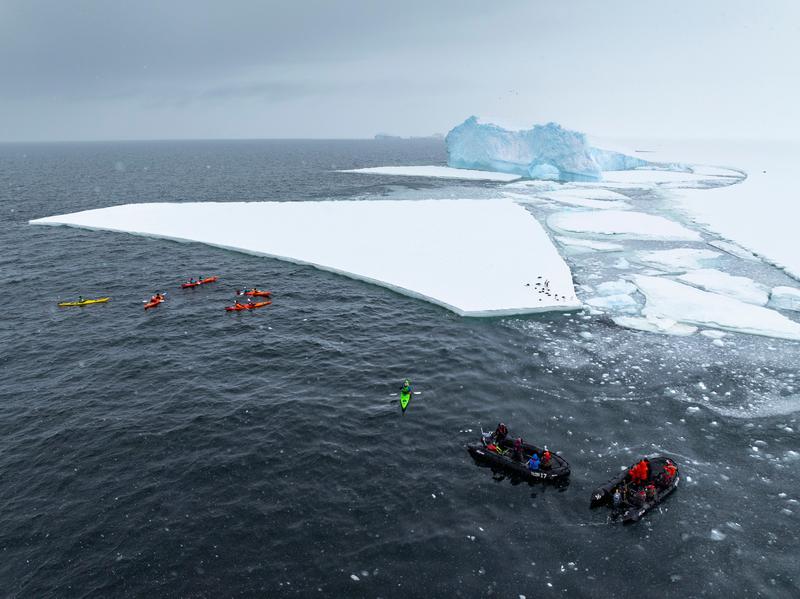
Kayakers and two zodiacs work along the edge of a flat ice floe with penguins standing on it, a weathered iceberg beyond, Bay of Whales, Ross Ice Shelf, the Ross Sea.
✎ This text is the AI Caption. It is the only thing written into Canto.
88Bay of Whales, Ross Ice Shelf highAerial scale, small craft against a big floe, penguins add the place · from GPS
Day13_BayOfWhales_RichardSidey-44.jpg
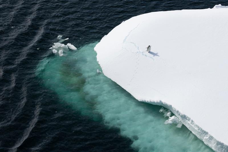
A single penguin stands on the rounded snow cap of an ice floe above a turquoise submerged shelf, Phantom Coast, Marie Byrd Land, the Ross Sea.
✎ This text is the AI Caption. It is the only thing written into Canto.
88Phantom Coast, Marie Byrd Land highAnimal small in a big clean scene, Carson's scale pick; species not resolvable · from GPS
Day15-22_PhantomCoast_RichardSidey-5.jpg
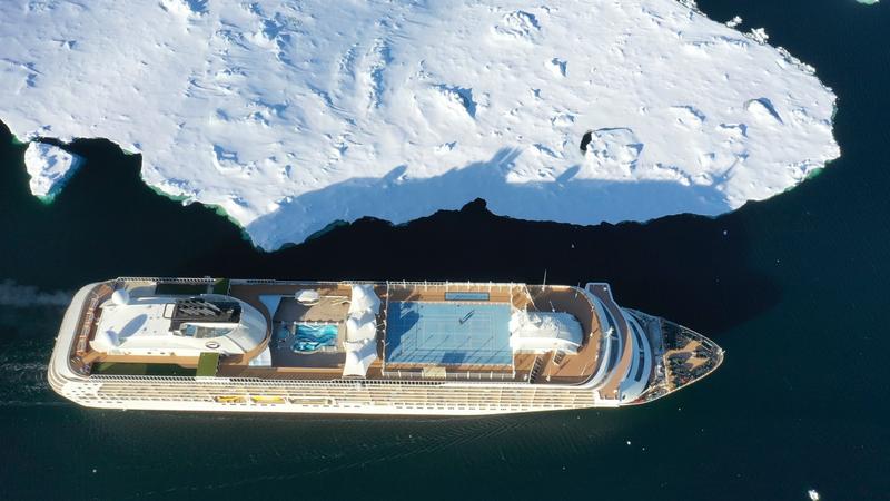
A top-down aerial of a large expedition cruise ship's upper decks, pool and sports court visible, moored against the edge of the fast ice, Phantom Coast, Marie Byrd Land, the Ross Sea.
✎ This text is the AI Caption. It is the only thing written into Canto.
88Phantom Coast, Marie Byrd Land highClean overhead of the whole vessel against ice; deck detail unusually legible
Day15-22_PhantomCoast_RichardSidey-8.jpg
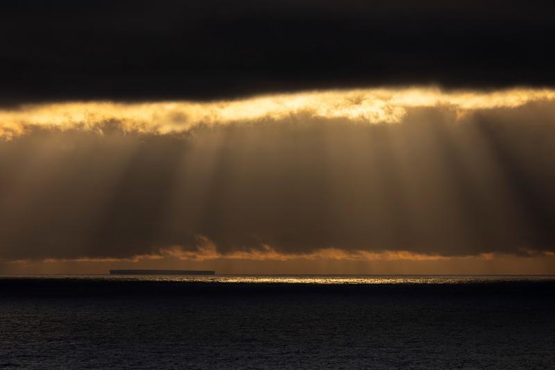
Rays break under a dark cloud bank and light the sea around a distant tabular iceberg, Phantom Coast, Marie Byrd Land, the Ross Sea.
✎ This text is the AI Caption. It is the only thing written into Canto.
88Phantom Coast, Marie Byrd Land highMoody light and a tiny berg for scale; the best of the ray frames · from GPS
Day15-22_PhantomCoast_RichardSidey-14.jpg
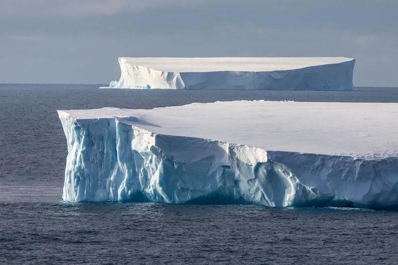
Two tabular icebergs in line, the near one showing a blue fluted wall and a clean snow-covered top, Phantom Coast, Marie Byrd Land, the Ross Sea.
✎ This text is the AI Caption. It is the only thing written into Canto.
88Phantom Coast, Marie Byrd Land highTextbook tabular pair, blue ice wall lit side on; sharp and rich
Day15-22_PhantomCoast_RichardSidey-21.jpg
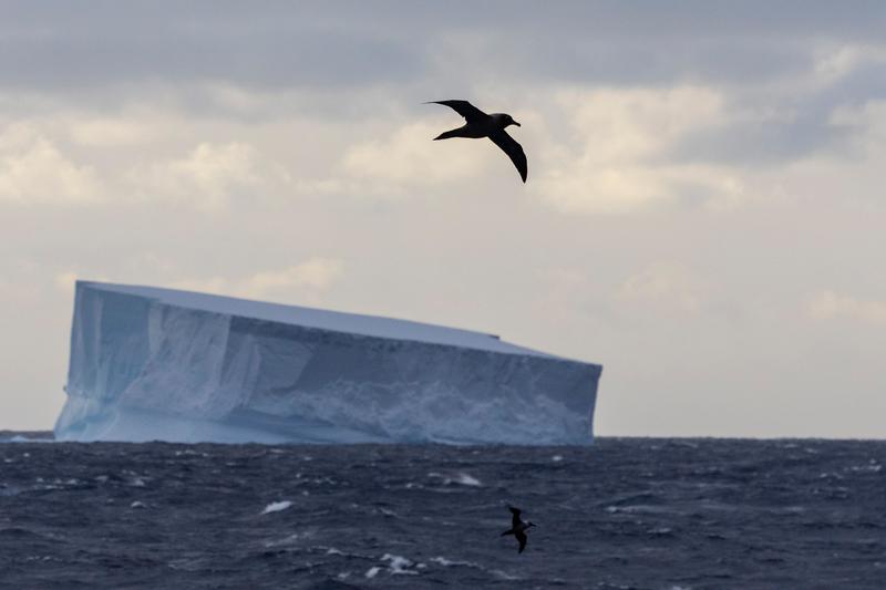
A large dark seabird glides past a tilted tabular iceberg while a second bird skims the swell below, Phantom Coast, Marie Byrd Land, the Ross Sea.
✎ This text is the AI Caption. It is the only thing written into Canto.
88Phantom Coast, Marie Byrd Land highBird in flight plus berg is animal in a scene; silhouette blocks species ID
Day15-22_PhantomCoast_RichardSidey-85.jpg
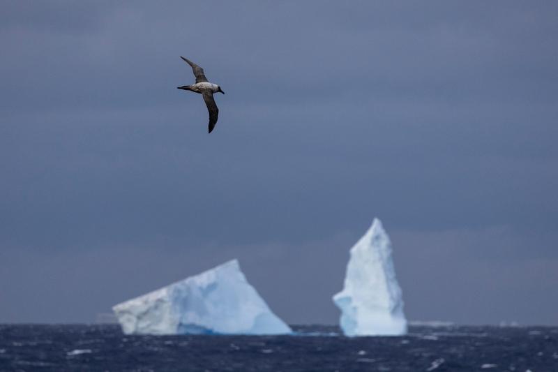
A large seabird with a pale head glides above two icebergs on a deep blue sea, Phantom Coast, Marie Byrd Land, the Ross Sea.
✎ This text is the AI Caption. It is the only thing written into Canto.
88Phantom Coast, Marie Byrd Land highWings fully spread and sharp; pale head visible but species not certain
Day15-22_PhantomCoast_RichardSidey-79.jpg
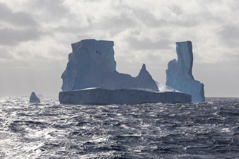
The twin-towered iceberg from side on, sunlight glittering off the swell in front of it, Phantom Coast, Marie Byrd Land, the Ross Sea.
✎ This text is the AI Caption. It is the only thing written into Canto.
88Phantom Coast, Marie Byrd Land highCleanest profile of the berg with a lit sea; a close second to its sibling
Day15-22_PhantomCoast_RichardSidey-91.jpg
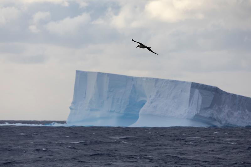
An albatross glides on stiff wings above a long tabular iceberg with a wave-cut arch at its base, Phantom Coast, Marie Byrd Land, the Ross Sea.
✎ This text is the AI Caption. It is the only thing written into Canto.
88Phantom Coast, Marie Byrd Land highBird and berg both clean; long narrow wings and hooked bill read albatross
Day15-22_PhantomCoast_RichardSidey-86.jpg
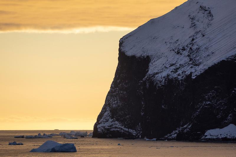
A snow-streaked dark cliff drops straight into the sea with small bergs on golden water under a low sun, Cape Adare, the Ross Sea.
✎ This text is the AI Caption. It is the only thing written into Canto.
87Cape Adare highWarm low light on a black snow-capped headland; no distinctive profile to name · from GPS
Day8_CapeAdare_RichardSidey-5.jpg
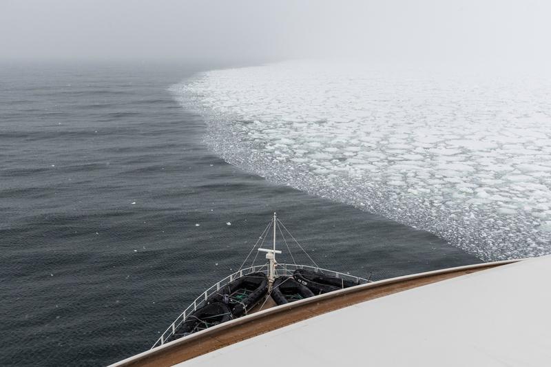
The ship's bow runs along a sharp ice edge where open water meets unbroken pack ice under low fog.
✎ This text is the AI Caption. It is the only thing written into Canto.
87Terra Nova Bay ice edge lowDiagonal ice edge splits the frame; bow gives scale without dominating
Day9_IceEdge_RichardSidey-3.jpg
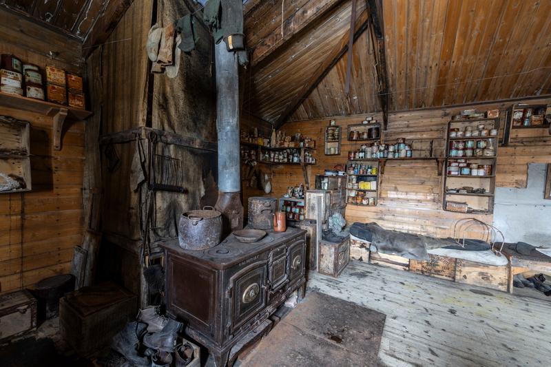
A wide view inside a preserved hut shows the cast iron range and flue, a bunk under furs, and shelves of labelled tins and bottles along the timber walls, Cape Royds, the Ross Sea.
✎ This text is the AI Caption. It is the only thing written into Canto.
87Cape Royds highSame hut and stove as the other interior, wider angle showing the bunk · from GPS
Day10_CapeRoyds_RichardSidey-14.jpg
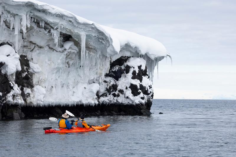
Two paddlers in a tandem kayak pass beneath a black rock headland hung with snow cornices and long icicles, Cape Royds, the Ross Sea.
✎ This text is the AI Caption. It is the only thing written into Canto.
87Cape Royds highTextbook scale juxtaposition, kayak tiny under the ice-hung cliff · from GPS
Day10_CapeRoyds_RichardSidey-18.jpg
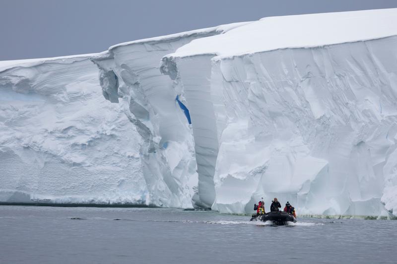
A zodiac carrying four passengers runs along the foot of a tall tabular ice wall streaked with a vein of blue meltwater ice, Bartlett Inlet, Ross Ice Shelf, the Ross Sea.
✎ This text is the AI Caption. It is the only thing written into Canto.
87Bartlett Inlet, Ross Ice Shelf highSmall boat dwarfed by a sculpted ice wall; blue vein gives the face depth · from GPS
Day14_BartlettInlet_RichardSidey-19.jpg
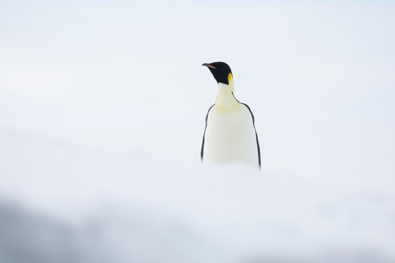
An emperor penguin stands in near whiteout, its head and shoulders the only dark shapes in an otherwise white frame, Bartlett Inlet, Ross Ice Shelf, the Ross Sea.
✎ This text is the AI Caption. It is the only thing written into Canto.
87Bartlett Inlet, Ross Ice Shelf highMinimal high-key composition, emperor confirmed by yellow neck wash and ear patch · from GPS
Day14_BartlettInlet_RichardSidey-20.jpg
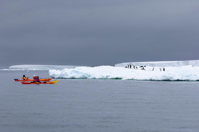
Two double kayaks paddle past a low floe where a line of emperor penguins stands, with a flat ice front on the horizon behind, Bartlett Inlet, Ross Ice Shelf, the Ross Sea.
✎ This text is the AI Caption. It is the only thing written into Canto.
87Bartlett Inlet, Ross Ice Shelf highKayaks small in a wide ice scene with penguins; scale and story in one frame · from GPS
Day14_BartlettInlet_RichardSidey-23.jpg
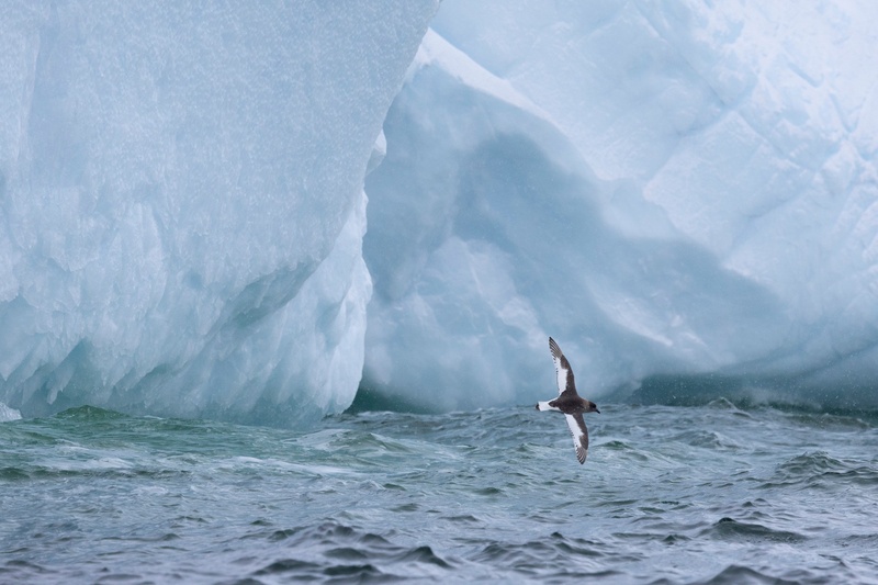
An Antarctic petrel banks low over choppy water in front of the undercut face of a blue iceberg, Bay of Whales, Ross Ice Shelf, the Ross Sea.
✎ This text is the AI Caption. It is the only thing written into Canto.
87Bay of Whales, Ross Ice Shelf highChocolate hood with broad white wing panels and white belly is diagnostic Antarctic petrel · from GPS
Day13_BayOfWhales_RichardSidey-14.jpg
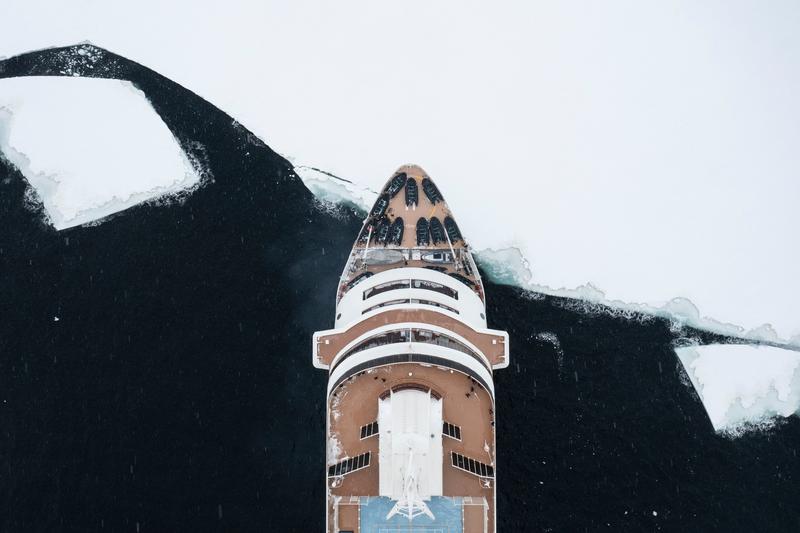
A vertical aerial directly above the bow of an expedition cruise ship, with stowed zodiacs on the foredeck, snow falling and a broken ice edge crossing the black water, Bay of Whales, Ross Ice Shelf, the Ross Sea.
✎ This text is the AI Caption. It is the only thing written into Canto.
87Bay of Whales, Ross Ice Shelf highTop-down graphic frame with falling snow; unusual angle on the vessel · from GPS
Day13_BayOfWhales_RichardSidey-35.jpg
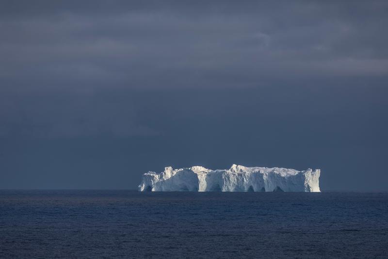
A sunlit tabular iceberg glows against a dark storm sky over deep blue water, Phantom Coast, Marie Byrd Land, the Ross Sea.
✎ This text is the AI Caption. It is the only thing written into Canto.
87Phantom Coast, Marie Byrd Land highHigh contrast spotlit berg against near black cloud; minimal and strong · from GPS
Day15-22_PhantomCoast_RichardSidey-18.jpg
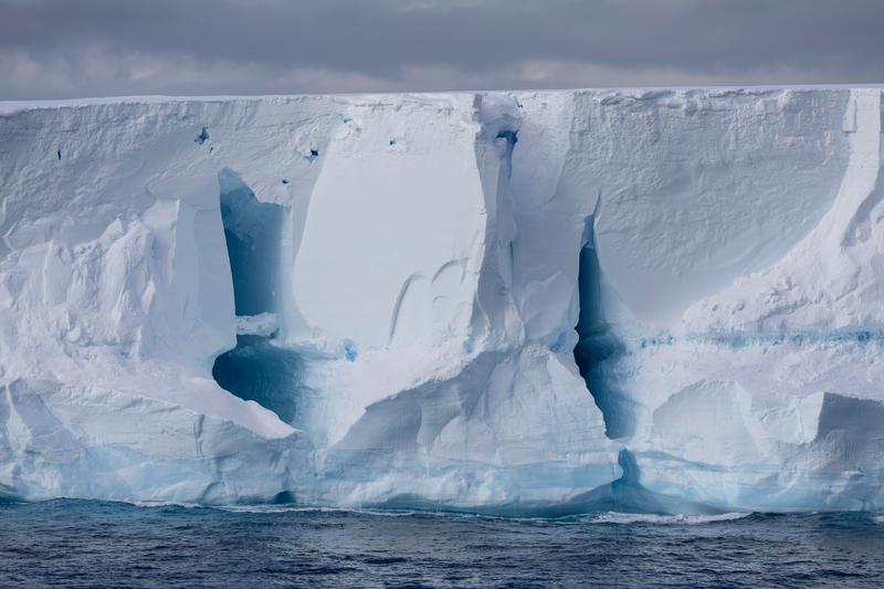
A long tabular iceberg wall filling the frame, deep blue caverns and vertical fracture lines running down to the waterline, Phantom Coast, Marie Byrd Land, the Ross Sea.
✎ This text is the AI Caption. It is the only thing written into Canto.
87Phantom Coast, Marie Byrd Land highWall to wall ice face; no ends visible so called a berg, not the shelf · from GPS
Day15-22_PhantomCoast_RichardSidey-25.jpg
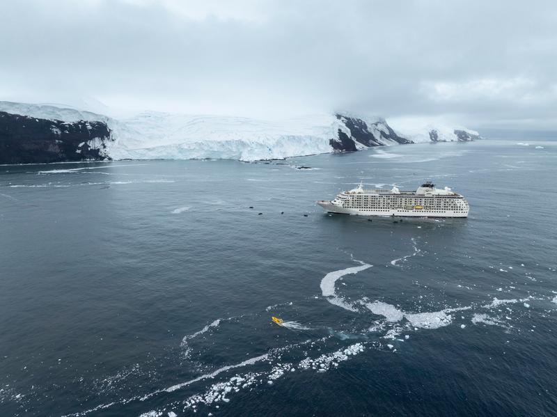
An aerial of MS The World anchored off a glaciated coast, a broad glacier front behind and a small yellow craft crossing the brash ice in the foreground, Walgreen Coast, Amundsen Sea, the Ross Sea.
✎ This text is the AI Caption. It is the only thing written into Canto.
87Walgreen Coast, Amundsen Sea highShip against a long glacier front with brash swirls leading in; strong scale · from GPS
Day23_PeterØy_RichardSidey-6.jpg
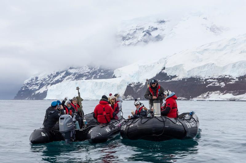
Three zodiacs raft together during a cruise, guests in red parkas holding hot drinks from a flask, a glacier and snow-covered slopes behind, Walgreen Coast, Amundsen Sea, the Ross Sea.
✎ This text is the AI Caption. It is the only thing written into Canto.
87Walgreen Coast, Amundsen Sea highGuest experience frame, hot drinks and rafted boats under a glacier · from GPS
Day23_PeterØy_RichardSidey-4.jpg
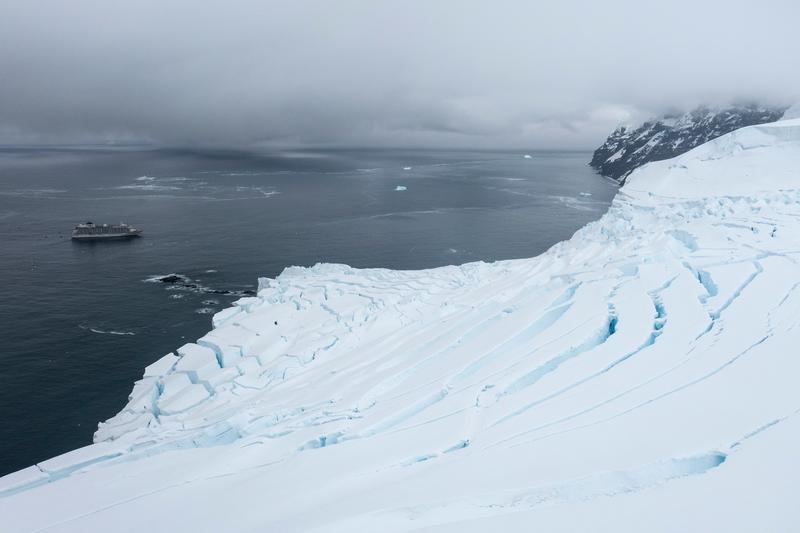
An aerial across a heavily crevassed ice cap sloping to the sea, MS The World lying small in open water beyond, Walgreen Coast, Amundsen Sea, the Ross Sea.
✎ This text is the AI Caption. It is the only thing written into Canto.
87Walgreen Coast, Amundsen Sea highCrevasse field fills two thirds, ship tiny; the scale pick Carson favours · from GPS
Day23_PeterØy_RichardSidey-10.jpg
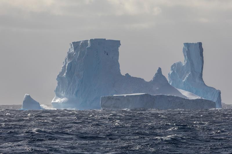
A massive iceberg with two tower-like blocks and a low tabular apron stands in a heavy swell, Phantom Coast, Marie Byrd Land, the Ross Sea.
✎ This text is the AI Caption. It is the only thing written into Canto.
87Phantom Coast, Marie Byrd Land highDistinctive twin-tower berg shot in rough sea; flatter light than its siblings
Day15-22_PhantomCoast_RichardSidey-88.jpg
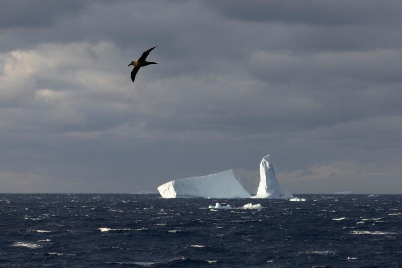
A large seabird banks over a dark swell with a tabular iceberg and an ice pinnacle behind under stormy cloud, Phantom Coast, Marie Byrd Land, the Ross Sea.
✎ This text is the AI Caption. It is the only thing written into Canto.
87Phantom Coast, Marie Byrd Land highBird placed high left against dark cloud with ice below; strong separation
Day15-22_PhantomCoast_RichardSidey-76.jpg
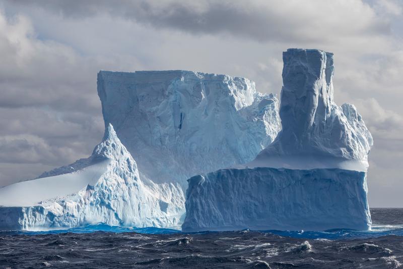
A large iceberg of stacked blue-white blocks and a squared tower fills the frame above a running swell, Phantom Coast, Marie Byrd Land, the Ross Sea.
✎ This text is the AI Caption. It is the only thing written into Canto.
87Phantom Coast, Marie Byrd Land highTightest framing on this berg, good side light in the blue ice
Day15-22_PhantomCoast_RichardSidey-94.jpg
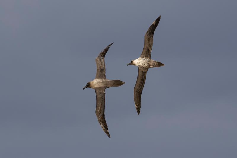
Two albatross bank together against a plain grey sky, brown mottled bodies and pale faces showing, Phantom Coast, Marie Byrd Land, the Ross Sea.
✎ This text is the AI Caption. It is the only thing written into Canto.
87Phantom Coast, Marie Byrd Land highSharp pair in flight; brown body and pale face fit a young bird, species open
Day15-22_PhantomCoast_RichardSidey-77.jpg
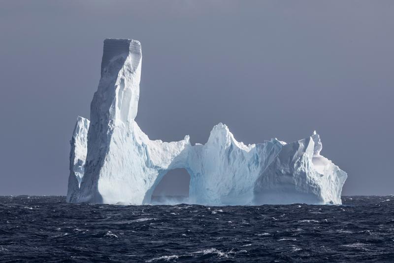
An iceberg with a tall fin and a wave-cut arch through its middle stands on a wind-driven sea, Phantom Coast, Marie Byrd Land, the Ross Sea.
✎ This text is the AI Caption. It is the only thing written into Canto.
87Phantom Coast, Marie Byrd Land highThe arch and fin make this the most sculptural berg in the run
Day15-22_PhantomCoast_RichardSidey-96.jpg
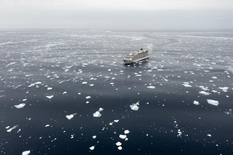
MS The World sits alone in a wide field of scattered ice floes under flat grey light, seen from the air, likely Ross Sea, on passage, the Ross Sea.
✎ This text is the AI Caption. It is the only thing written into Canto.
86Ross Sea, on passage mediumStrong scale juxtaposition, ship small in open pack; no landform to place it · from GPS
Day7_AtSea_RichardSidey-12.jpg
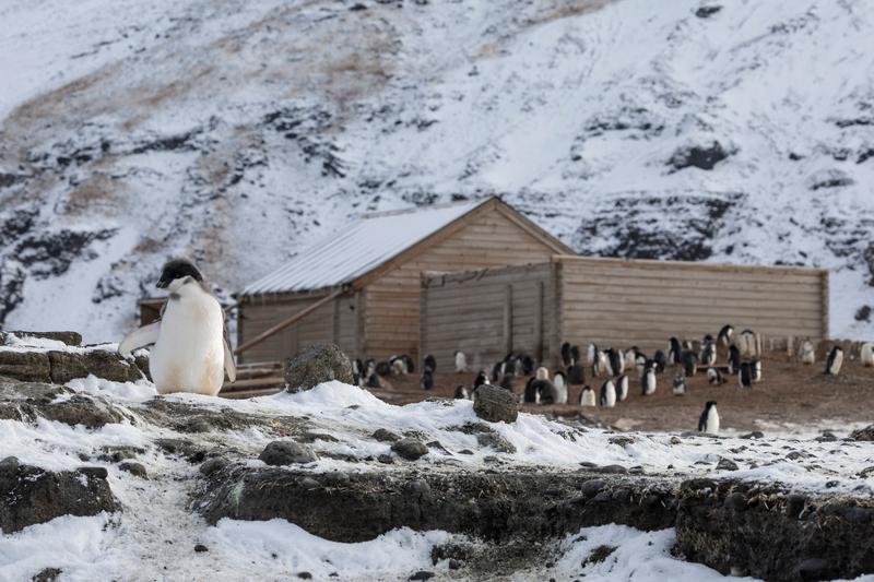
An Adelie penguin chick in moult stands on a rock ledge in front of a weathered timber expedition hut with penguins gathered along its wall, likely Cape Adare, the Ross Sea.
✎ This text is the AI Caption. It is the only thing written into Canto.
86Cape Adare mediumSame hut and colony as the aerial; animal plus historic structure in one frame
Day8_CapeAdare_RichardSidey-8.jpg
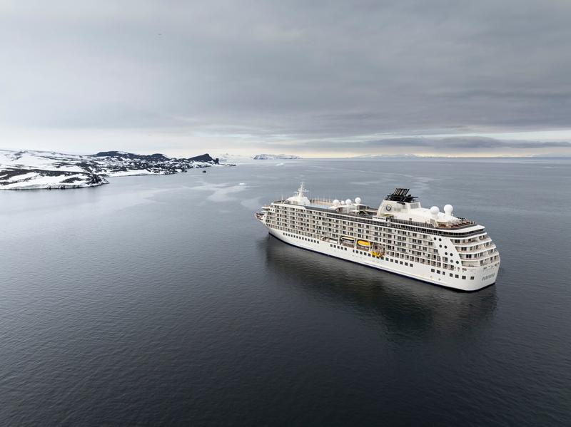
An aerial view of MS The World lying at anchor in calm water off a low snow-covered coast under heavy cloud, Cape Royds, the Ross Sea.
✎ This text is the AI Caption. It is the only thing written into Canto.
86Cape Royds highWhole vessel clean in frame with room around it; coast too generic to name · from GPS
Day10_CapeRoyds_RichardSidey-20.jpg
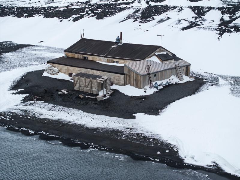
An aerial view of a preserved timber expedition hut on black volcanic gravel above a snow-covered shore, with a stacked crate wall, skis leaning against the wall and a lean-to annex along one side, Cape Evans, the Ross Sea.
✎ This text is the AI Caption. It is the only thing written into Canto.
86Cape Evans highLarge historic hut with annex; site not nameable from pixels, GPS should place it · from GPS
Day11_CapeEvans_RichardSidey-16.jpg
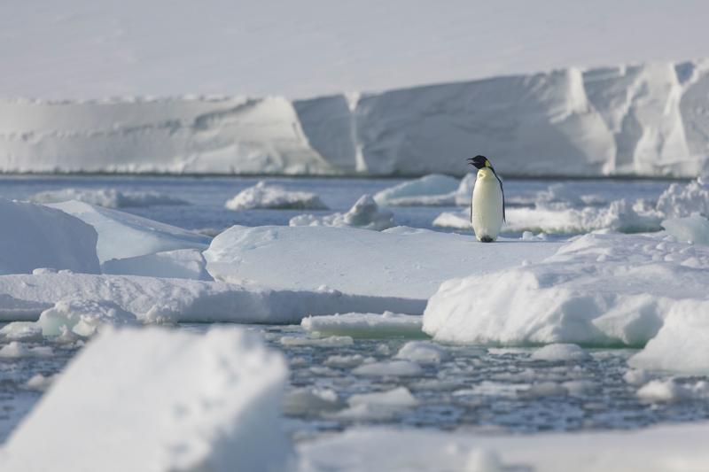
An emperor penguin stands on a pan of sea ice among scattered floes, with a long ice cliff behind on the horizon, Bartlett Inlet, Ross Ice Shelf, the Ross Sea.
✎ This text is the AI Caption. It is the only thing written into Canto.
86Bartlett Inlet, Ross Ice Shelf highAnimal in a scene with the ice front behind; wide and clean, Carson's preferred read · from GPS
Day14_BartlettInlet_RichardSidey-9.jpg
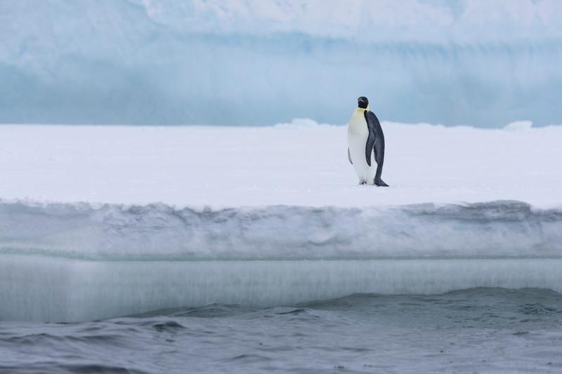
An emperor penguin stands near the edge of a thick pan of sea ice above dark water, with a blue iceberg wall behind, Bay of Whales, Ross Ice Shelf, the Ross Sea.
✎ This text is the AI Caption. It is the only thing written into Canto.
86Bay of Whales, Ross Ice Shelf highLayered ice edge, water and berg with one bird for scale; strong quiet frame · from GPS
Day13_BayOfWhales_RichardSidey-20.jpg
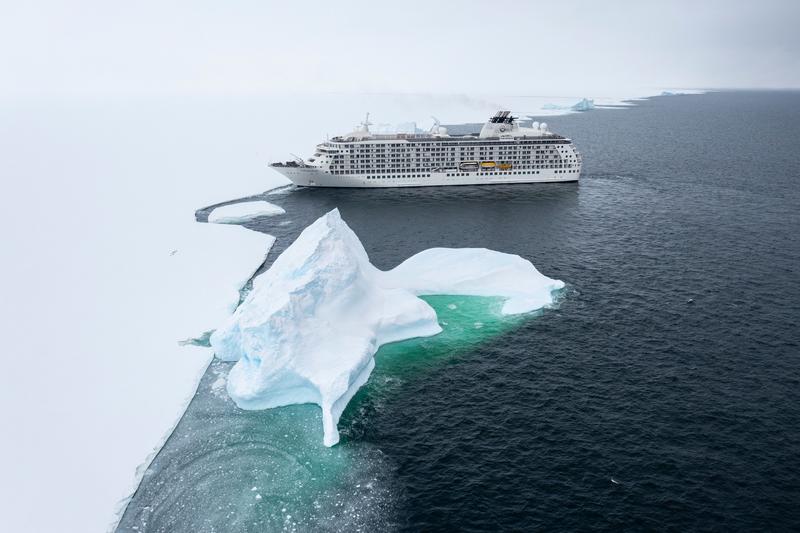
An expedition cruise ship lies off the ice edge beyond a sculpted iceberg with a bright green shelf under the surface, Bay of Whales, Ross Ice Shelf, the Ross Sea.
✎ This text is the AI Caption. It is the only thing written into Canto.
86Bay of Whales, Ross Ice Shelf highForeground berg gives depth to the ship at the ice edge · from GPS
Day13_BayOfWhales_RichardSidey-37.jpg
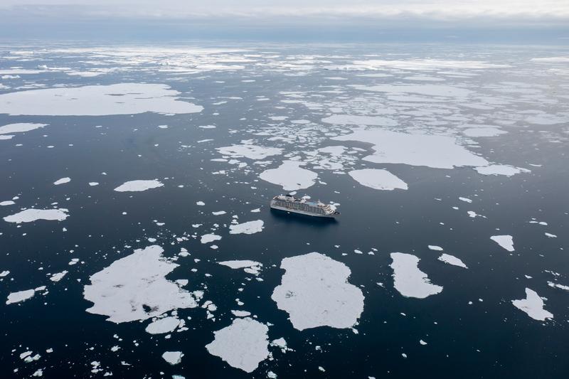
An aerial of MS The World threading loose pack ice, floes scattered to the horizon under a bright overcast, Phantom Coast, Marie Byrd Land, the Ross Sea.
✎ This text is the AI Caption. It is the only thing written into Canto.
86Phantom Coast, Marie Byrd Land highShip small in a wide field of floes, strong sense of remoteness · from GPS
Day15-22_PhantomCoast_RichardSidey-9.jpg
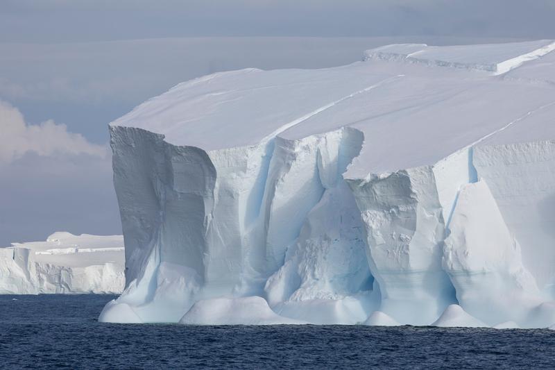
The sheer flank of a large tabular iceberg, meltwater channels and a wave-cut notch at the waterline, more tabular ice on the horizon, Phantom Coast, Marie Byrd Land, the Ross Sea.
✎ This text is the AI Caption. It is the only thing written into Canto.
86Phantom Coast, Marie Byrd Land highBig tabular berg fills the frame; sculpted wall reads well full bleed · from GPS
Day15-22_PhantomCoast_RichardSidey-2.jpg
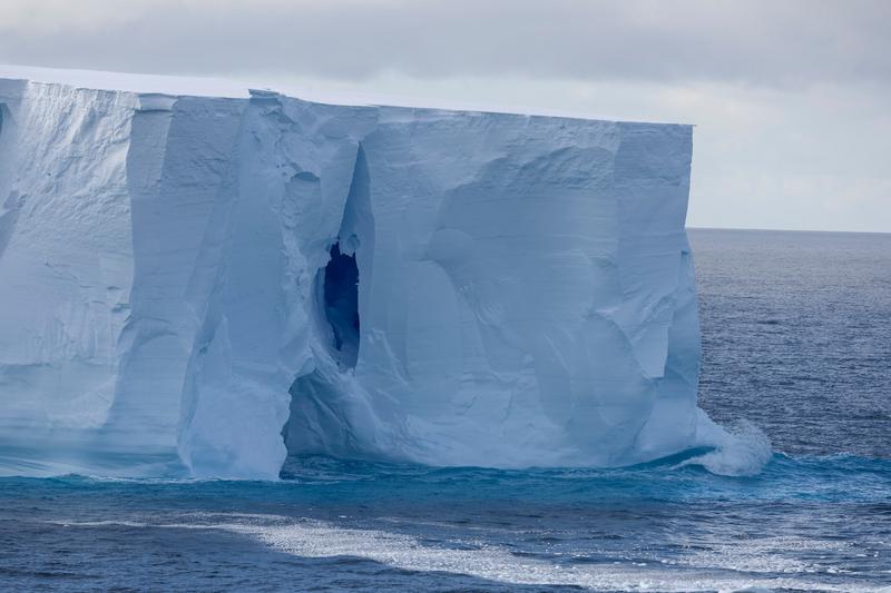
Swell breaks white along the foot of a tabular iceberg with a tall dark cleft split into its face, Phantom Coast, Marie Byrd Land, the Ross Sea.
✎ This text is the AI Caption. It is the only thing written into Canto.
86Phantom Coast, Marie Byrd Land highSurf at the ice foot gives scale; the cleft is the graphic hook · from GPS
Day15-22_PhantomCoast_RichardSidey-23.jpg
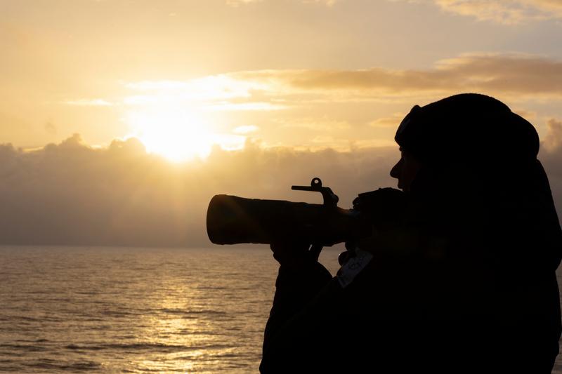
A photographer with a long telephoto lens works in silhouette against a low sun over the sea, Phantom Coast, Marie Byrd Land, the Ross Sea.
✎ This text is the AI Caption. It is the only thing written into Canto.
86Phantom Coast, Marie Byrd Land highClean rim-lit silhouette, warm sky; sells the shooting-from-deck moment
Day15-22_PhantomCoast_RichardSidey-36.jpg
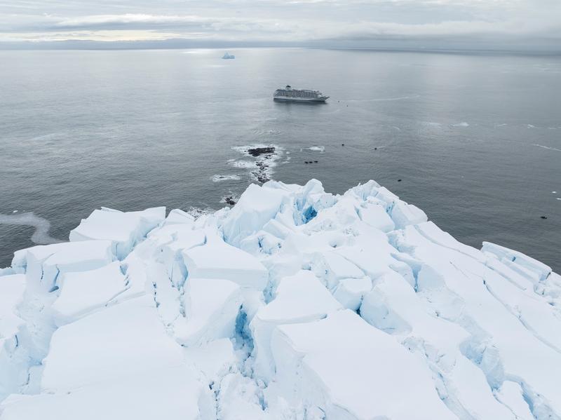
An aerial looking down a broken glacier snout to the sea, MS The World at anchor beyond an offshore reef, Walgreen Coast, Amundsen Sea, the Ross Sea.
✎ This text is the AI Caption. It is the only thing written into Canto.
86Walgreen Coast, Amundsen Sea highSame setup as its sibling, ice foreground and ship small on flat water · from GPS
Day23_PeterØy_RichardSidey-8.jpg
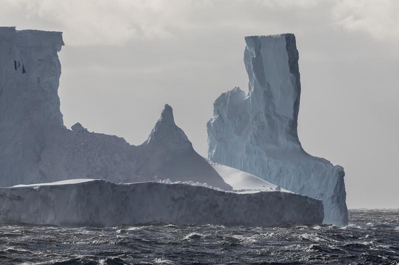
A tight view of the twin-towered iceberg, its square block and leaning column rising over a long snow ramp above a running sea, Phantom Coast, Marie Byrd Land, the Ross Sea.
✎ This text is the AI Caption. It is the only thing written into Canto.
86Phantom Coast, Marie Byrd Land highClosest crop of this berg; dark shapes on the ramp too small to call
Day15-22_PhantomCoast_RichardSidey-89.jpg
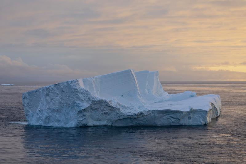
A large flat-topped iceberg with a sheared blue face floats in calm water under a pastel sunset sky, Cape Adare, the Ross Sea.
✎ This text is the AI Caption. It is the only thing written into Canto.
85Cape Adare highSoft warm light, whole berg in frame with breathing room, strong texture · from GPS
Day8_CapeAdare_RichardSidey-3.jpg
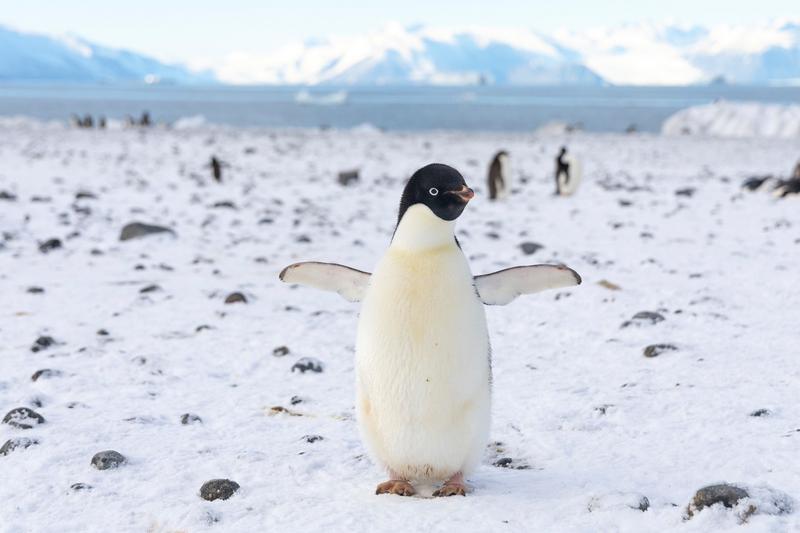
An Adelie penguin stands on snow with flippers held out, its colony and a glaciated range behind, Cape Adare, the Ross Sea.
✎ This text is the AI Caption. It is the only thing written into Canto.
85Cape Adare highWhite eye ring and all-black head confirm Adelie; clean subject with environment · from GPS
Day8_CapeAdare_RichardSidey-11.jpg
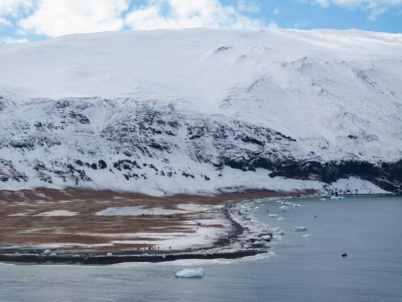
A snow dome rises above a rust-brown coastal plain where a line of visitors walks between a penguin colony and a zodiac waiting offshore, likely Cape Adare, the Ross Sea.
✎ This text is the AI Caption. It is the only thing written into Canto.
85Cape Adare mediumStrong scale, people tiny under the dome; same spit as the hut aerials
Day8_CapeAdare_RichardSidey-15.jpg
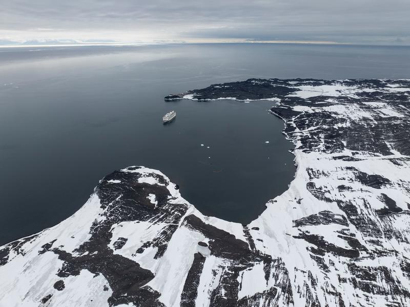
An aerial view of MS The World at anchor in a bay formed by a dark snow-patched volcanic headland, open sea running to the horizon, Cape Royds, the Ross Sea.
✎ This text is the AI Caption. It is the only thing written into Canto.
85Cape Royds highShip tiny against a big dark coast; strong scale, coastline not identifiable · from GPS
Day10_CapeRoyds_RichardSidey-22.jpg
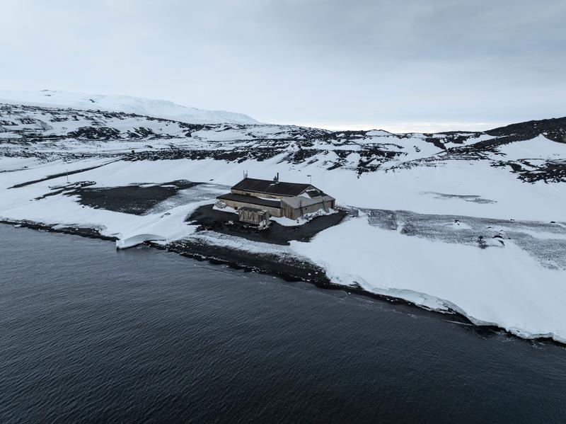
An aerial view of a large timber hut standing alone on a black gravel point between snowfields and dark water, Cape Evans, the Ross Sea.
✎ This text is the AI Caption. It is the only thing written into Canto.
85Cape Evans highWhole hut and its setting in one frame; nothing in view names the cape · from GPS
Day11_CapeEvans_RichardSidey-15.jpg
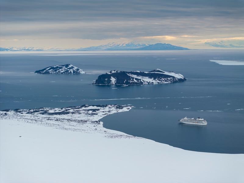
An elevated view across a frozen sound to two small rocky islands, with a long mountain range on the far horizon and an expedition cruise ship anchored off a snow-covered point, Cape Evans, the Ross Sea.
✎ This text is the AI Caption. It is the only thing written into Canto.
85Cape Evans highTwo dark islets offshore and a distant range across the sound; neither is nameable · from GPS
Day11_CapeEvans_RichardSidey-14.jpg
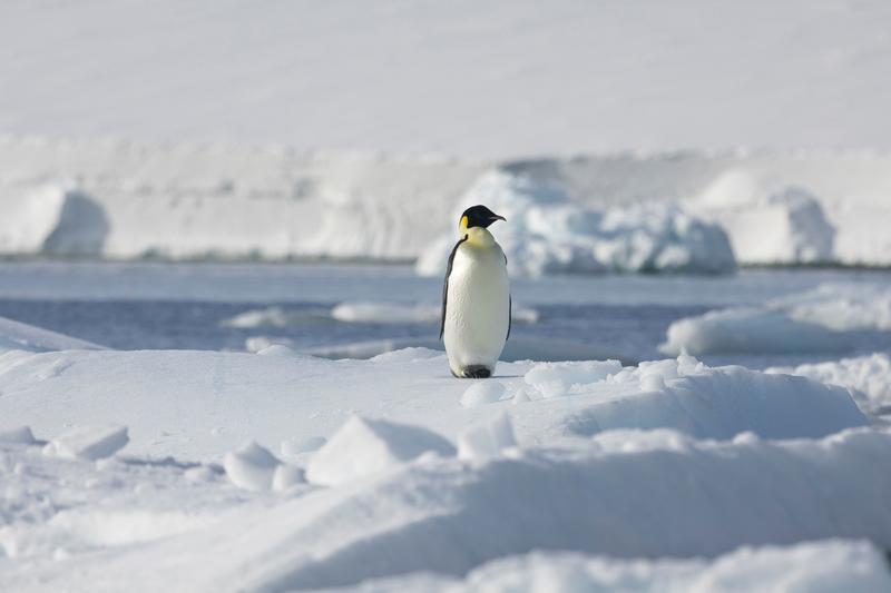
An emperor penguin stands alone on rafted sea ice in low sunlight, with a lead of open water and floes behind it, Bartlett Inlet, Ross Ice Shelf, the Ross Sea.
✎ This text is the AI Caption. It is the only thing written into Canto.
85Bartlett Inlet, Ross Ice Shelf highBright orange ear patch and yellow neck wash confirm emperor; clean sea-ice setting · from GPS
Day14_BartlettInlet_RichardSidey-10.jpg
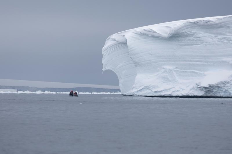
Two zodiacs sit small on grey water beside the wind-carved flank of a large iceberg, with a low ice front on the far horizon, Bartlett Inlet, Ross Ice Shelf, the Ross Sea.
✎ This text is the AI Caption. It is the only thing written into Canto.
85Bartlett Inlet, Ross Ice Shelf highBoats tiny against sculpted ice; the scale contrast is the picture · from GPS
Day14_BartlettInlet_RichardSidey-18.jpg
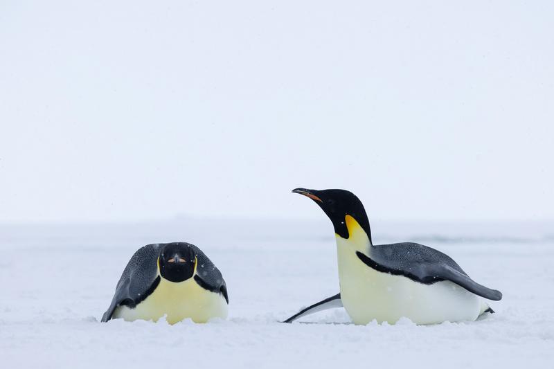
Two emperor penguins rest on flat snow, one lying flat on its belly facing the camera and the other raising its head beside it, Bay of Whales, Ross Ice Shelf, the Ross Sea.
✎ This text is the AI Caption. It is the only thing written into Canto.
85Bay of Whales, Ross Ice Shelf highTwo clean shapes with behaviour and space around them; light snow falling · from GPS
Day13_BayOfWhales_RichardSidey-29.jpg
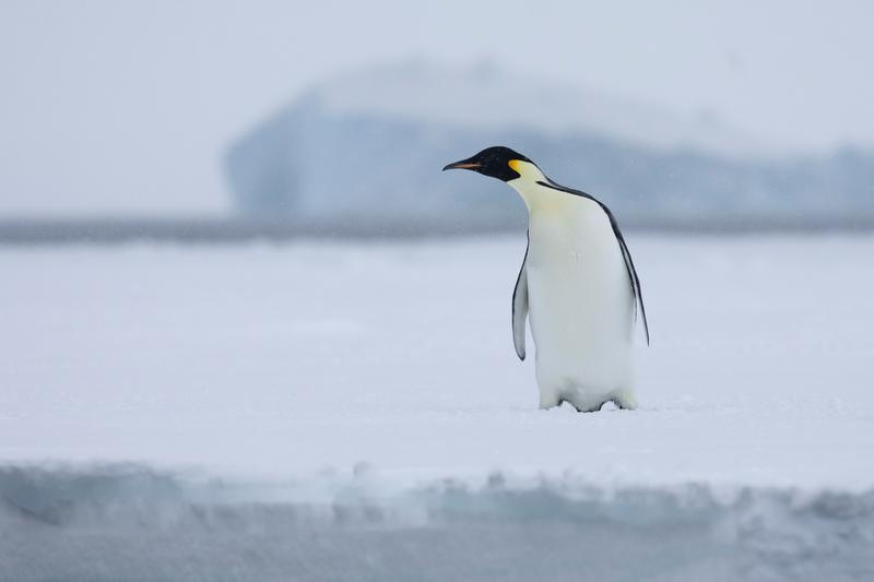
An emperor penguin walks across flat sea ice in falling snow, with a pale iceberg soft in the background, Bay of Whales, Ross Ice Shelf, the Ross Sea.
✎ This text is the AI Caption. It is the only thing written into Canto.
85Bay of Whales, Ross Ice Shelf highFalling snow, clean separation, whole bird with breathing room around it · from GPS
Day13_BayOfWhales_RichardSidey-22.jpg
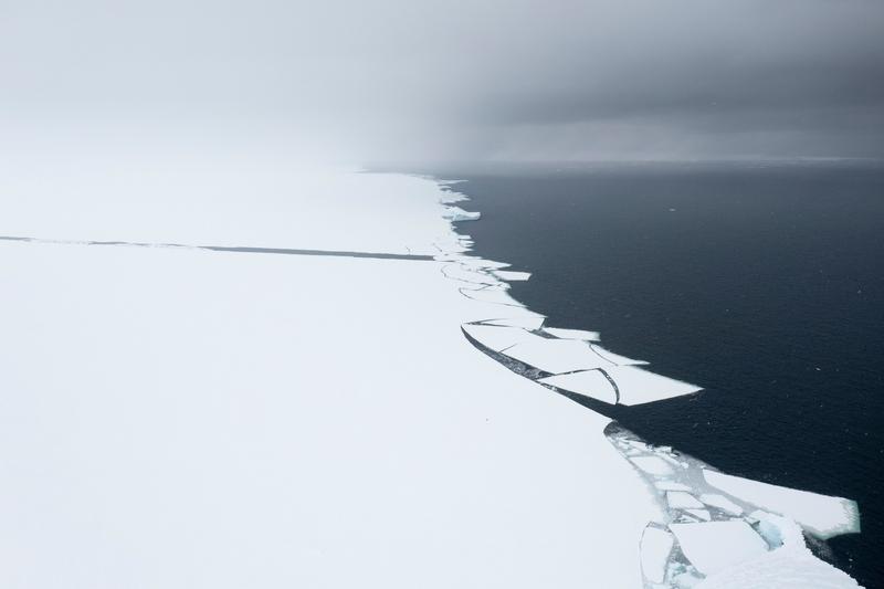
An aerial view of a fast ice edge breaking into angular floes where the white plain meets black open water, Bay of Whales, Ross Ice Shelf, the Ross Sea.
✎ This text is the AI Caption. It is the only thing written into Canto.
85Bay of Whales, Ross Ice Shelf highGraphic black and white split with cracked floes; abstract but genuinely striking · from GPS
Day13_BayOfWhales_RichardSidey-32.jpg
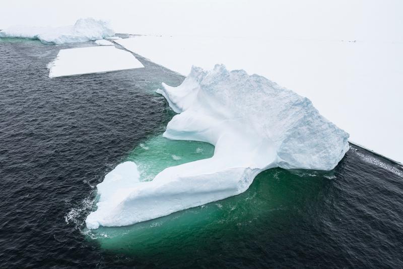
An iceberg lies alongside flat sea ice with its submerged shelf glowing green through the water, Bay of Whales, Ross Ice Shelf, the Ross Sea.
✎ This text is the AI Caption. It is the only thing written into Canto.
85Bay of Whales, Ross Ice Shelf highGreen underwater ledge against dark water; unusual colour and a clean shape · from GPS
Day13_BayOfWhales_RichardSidey-36.jpg
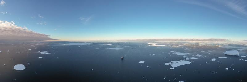
A panoramic aerial of MS The World alone among scattered floes under a high blue sky, penguins visible on one of the floes, likely Phantom Coast, Marie Byrd Land, the Ross Sea.
✎ This text is the AI Caption. It is the only thing written into Canto.
85Phantom Coast, Marie Byrd Land mediumPanorama, ship tiny in a vast icescape, the scale juxtaposition Carson picks · from GPS
Day15-22_PhantomCoast_RichardSidey-6.jpg
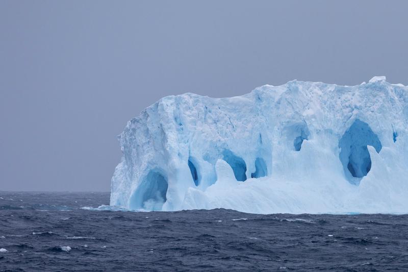
Deep blue caves and arches cut into the flank of an iceberg above a choppy sea, Phantom Coast, Marie Byrd Land, the Ross Sea.
✎ This text is the AI Caption. It is the only thing written into Canto.
85Phantom Coast, Marie Byrd Land highSaturated blue melt caves carry the frame against plain grey sky
Day15-22_PhantomCoast_RichardSidey-32.jpg
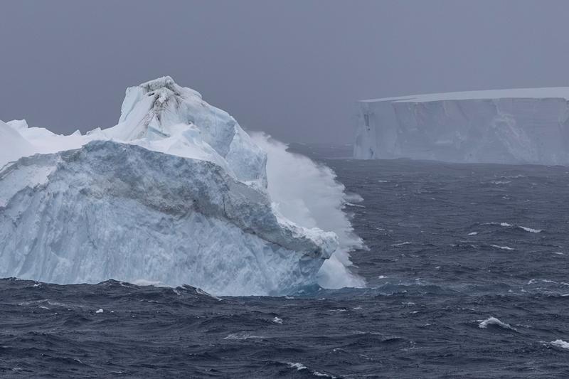
Spray blows off the back of an iceberg in a rough sea, a tabular berg standing in the mist behind, Phantom Coast, Marie Byrd Land, the Ross Sea.
✎ This text is the AI Caption. It is the only thing written into Canto.
85Phantom Coast, Marie Byrd Land highWind and spray give the frame weather and motion, rare in this run · from GPS
Day15-22_PhantomCoast_RichardSidey-30.jpg
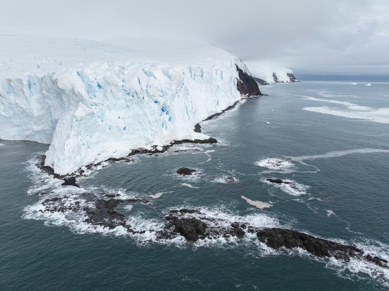
An aerial of a glacier front ending in an ice cliff above dark volcanic rock, surf breaking over reefs below, Walgreen Coast, Amundsen Sea, the Ross Sea.
✎ This text is the AI Caption. It is the only thing written into Canto.
85Walgreen Coast, Amundsen Sea highIce cap meeting black volcanic coast; distinctive but not identifiable · from GPS
Day23_PeterØy_RichardSidey-7.jpg
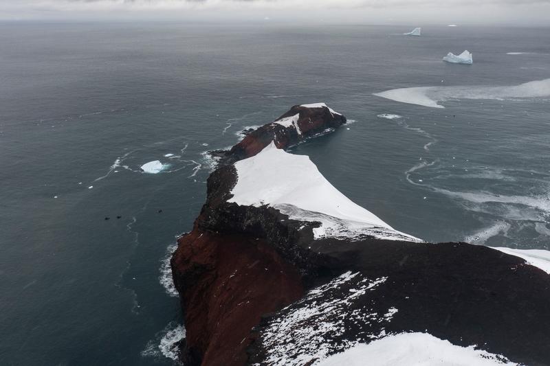
An aerial of a dark red volcanic ridge running out to sea under a cap of drifted snow, icebergs standing offshore, Walgreen Coast, Amundsen Sea, the Ross Sea.
✎ This text is the AI Caption. It is the only thing written into Canto.
85Walgreen Coast, Amundsen Sea highOxidised red scoria ridge is distinctive; no feature I can name from pixels · from GPS
Day23_PeterØy_RichardSidey-11.jpg
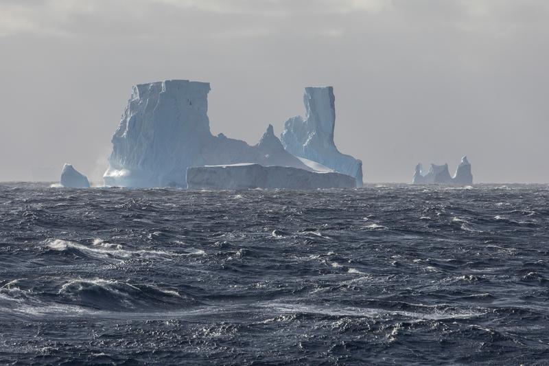
The twin-towered iceberg seen across a running swell in hazy backlight, smaller bergs strung out beyond it, Phantom Coast, Marie Byrd Land, the Ross Sea.
✎ This text is the AI Caption. It is the only thing written into Canto.
85Phantom Coast, Marie Byrd Land highForeground swell carries the frame; berg smaller and hazier here
Day15-22_PhantomCoast_RichardSidey-87.jpg
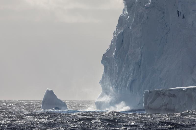
Swell explodes white against the foot of a towering iceberg wall, a smaller berg standing in the spray-hazed distance, Phantom Coast, Marie Byrd Land, the Ross Sea.
✎ This text is the AI Caption. It is the only thing written into Canto.
85Phantom Coast, Marie Byrd Land highBacklit spray at the ice foot gives real scale and weather
Day15-22_PhantomCoast_RichardSidey-90.jpg
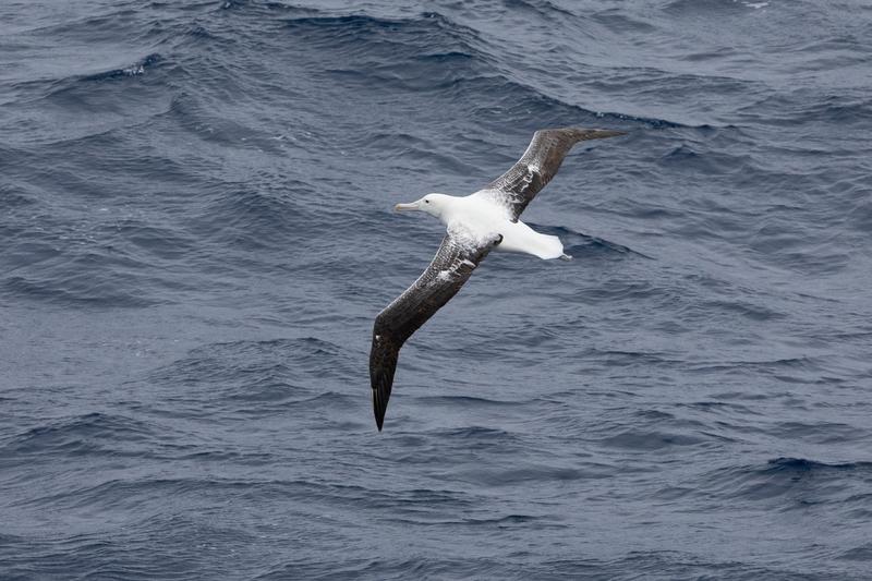
A great albatross banks low over dark Southern Ocean swell on long stiff wings, Campbell and Auckland Islands, the Ross Sea.
✎ This text is the AI Caption. It is the only thing written into Canto.
84Campbell and Auckland Islands highWhite body, dark mottled upperwing, pink bill; royal vs wandering not separable here · from GPS
Day3_AtSea_RichardSidey-3.jpg
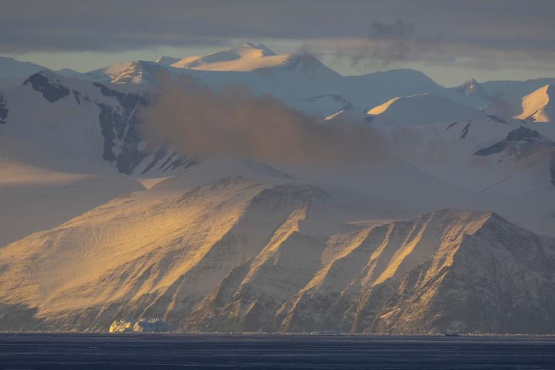
Low sun rakes across a heavily glaciated coastal mountain range with a dark cloud band caught on the ridgeline, Cape Adare, the Ross Sea.
✎ This text is the AI Caption. It is the only thing written into Canto.
84Cape Adare highLayered light on a big continental range; no single peak identifiable · from GPS
Day8_CapeAdare_RichardSidey-4.jpg

An emperor penguin in juvenile plumage stands alone among snow-covered ice hummocks, Terra Nova Bay ice edge, the Ross Sea.
✎ This text is the AI Caption. It is the only thing written into Canto.
84Terra Nova Bay ice edge highPale yellow neck wash and whitish ear patch read juvenile emperor, not Adelie · from GPS
Day9_IceEdge_RichardSidey-6.jpg
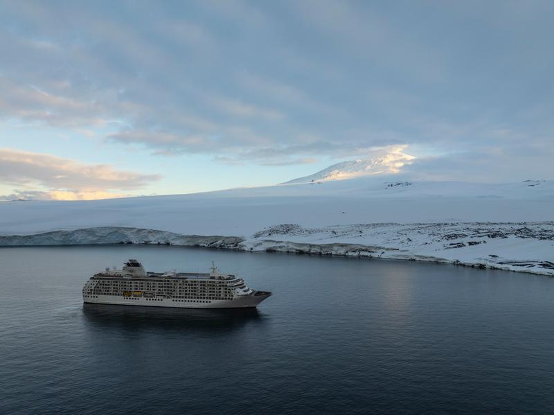
A large expedition cruise ship lies at anchor in dark water below a broad snow-covered volcanic mountain and a low coastal ice cliff, under a pale evening sky, Cape Evans, the Ross Sea.
✎ This text is the AI Caption. It is the only thing written into Canto.
84Cape Evans highBroad snow volcano above low ice cliff; no plume or landmark to name the peak · from GPS
Day11_CapeEvans_RichardSidey-13.jpg
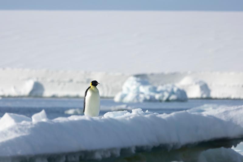
An emperor penguin stands on a broken floe among rafted sea ice, with a flat ice front running across the background, Bartlett Inlet, Ross Ice Shelf, the Ross Sea.
✎ This text is the AI Caption. It is the only thing written into Canto.
84Bartlett Inlet, Ross Ice Shelf highEmperor confirmed by orange ear patch; animal set in a wide ice environment · from GPS
Day14_BartlettInlet_RichardSidey-11.jpg
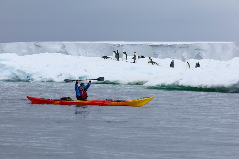
A kayaker lifts a paddle overhead in a red and yellow sea kayak while emperor penguins stand along the floe edge behind, Bartlett Inlet, Ross Ice Shelf, the Ross Sea.
✎ This text is the AI Caption. It is the only thing written into Canto.
84Bartlett Inlet, Ross Ice Shelf highPosed celebration; strong colour against ice but the gesture reads as a snapshot · from GPS
Day14_BartlettInlet_RichardSidey-24.jpg
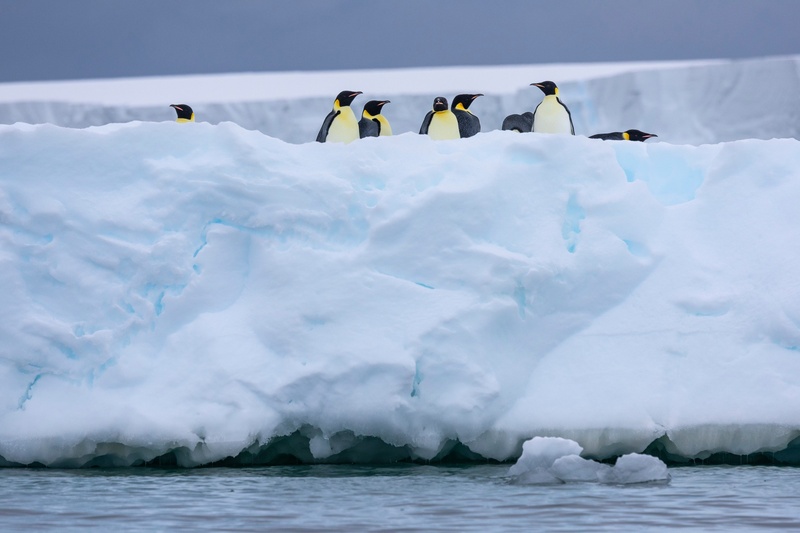
A group of emperor penguins stands on the top of a thick floe shot through with blue ice, under a dark grey sky, Bartlett Inlet, Ross Ice Shelf, the Ross Sea.
✎ This text is the AI Caption. It is the only thing written into Canto.
84Bartlett Inlet, Ross Ice Shelf highDark sky separates the white ice; birds sit cleanly along the floe top
Day14_BartlettInlet_RichardSidey-28.jpg
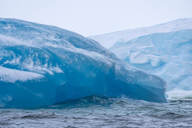
A capsized iceberg shows its polished deep blue underside above choppy water, with fractured white ice behind, Bay of Whales, Ross Ice Shelf, the Ross Sea.
✎ This text is the AI Caption. It is the only thing written into Canto.
84Bay of Whales, Ross Ice Shelf highSmooth rolled blue ice against broken white; unusual colour and texture · from GPS
Day13_BayOfWhales_RichardSidey-9.jpg
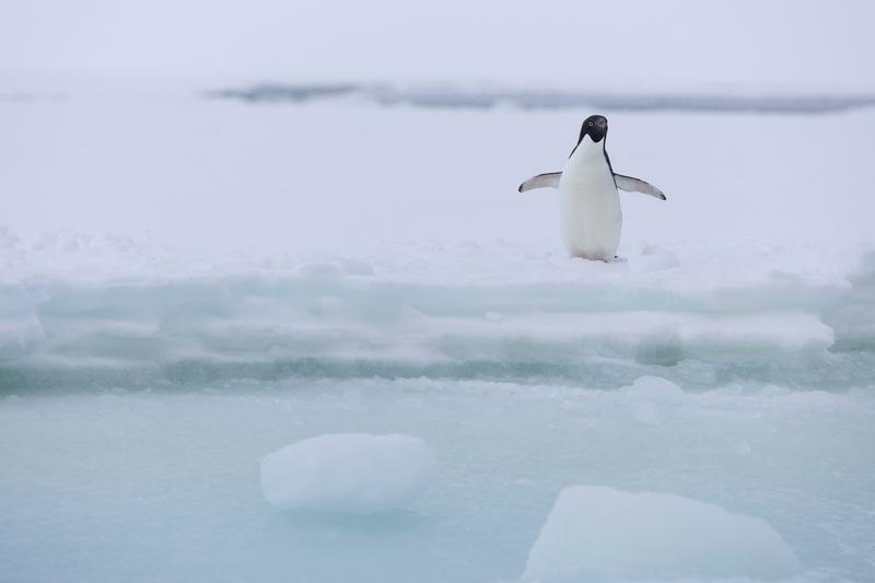
An Adelie penguin stands with both flippers spread on a low pan of sea ice in soft flat light, Bay of Whales, Ross Ice Shelf, the Ross Sea.
✎ This text is the AI Caption. It is the only thing written into Canto.
84Bay of Whales, Ross Ice Shelf highWhite eye ring and small black head confirm Adelie; pale minimal frame with room · from GPS
Day13_BayOfWhales_RichardSidey-17.jpg
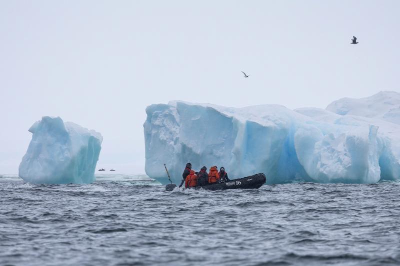
A zodiac of passengers in orange jackets runs past a pair of blue-veined icebergs while seabirds pass overhead, Bay of Whales, Ross Ice Shelf, the Ross Sea.
✎ This text is the AI Caption. It is the only thing written into Canto.
84Bay of Whales, Ross Ice Shelf highColour of the jackets against blue ice; boat number is a marking not a place · from GPS
Day13_BayOfWhales_RichardSidey-15.jpg
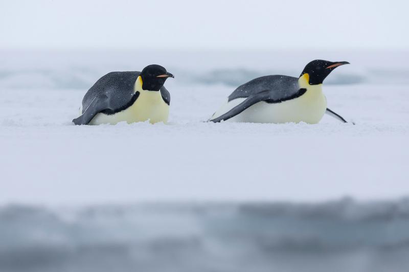
Two emperor penguins lie on their bellies on flat sea ice, one facing the other, with snow settling on their backs, Bay of Whales, Ross Ice Shelf, the Ross Sea.
✎ This text is the AI Caption. It is the only thing written into Canto.
84Bay of Whales, Ross Ice Shelf highBehaviour and symmetry in a very clean white field; both birds whole in frame · from GPS
Day13_BayOfWhales_RichardSidey-26.jpg
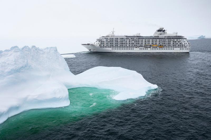
A large white expedition cruise ship passes behind a grounded iceberg whose submerged shelf glows green through the water, Bay of Whales, Ross Ice Shelf, the Ross Sea.
✎ This text is the AI Caption. It is the only thing written into Canto.
84Bay of Whales, Ross Ice Shelf highGreen underwater ice shelf leads to the ship; clean flat light · from GPS
Day13_BayOfWhales_RichardSidey-38.jpg
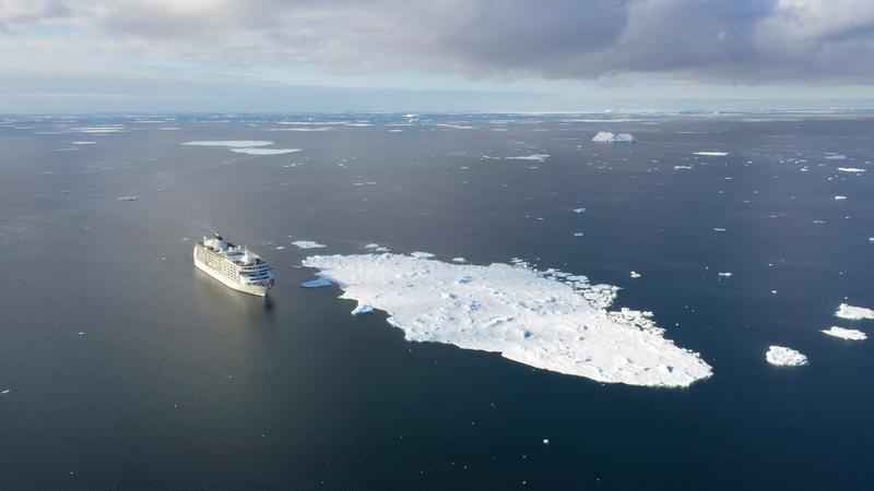
MS The World lies alongside a broad rubble-topped ice floe in open water, cloud shadow moving across the ice behind, Phantom Coast, Marie Byrd Land, the Ross Sea.
✎ This text is the AI Caption. It is the only thing written into Canto.
84Phantom Coast, Marie Byrd Land highShip and floe balanced, big sky; slightly flat compared to its siblings
Day15-22_PhantomCoast_RichardSidey-7.jpg
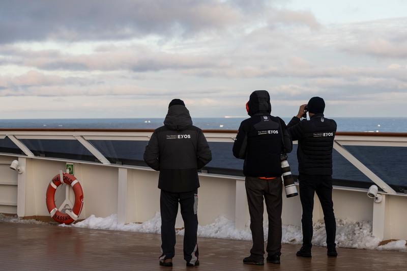
Three guests in expedition jackets watch the ice from the ship's open deck, one glassing the horizon with binoculars and another carrying a long telephoto lens, Phantom Coast, Marie Byrd Land, the Ross Sea.
✎ This text is the AI Caption. It is the only thing written into Canto.
84Phantom Coast, Marie Byrd Land highEYOS branding legible on all three jackets; lifebuoy port of registry, not a place · from GPS
Day15-22_PhantomCoast_RichardSidey-15.jpg
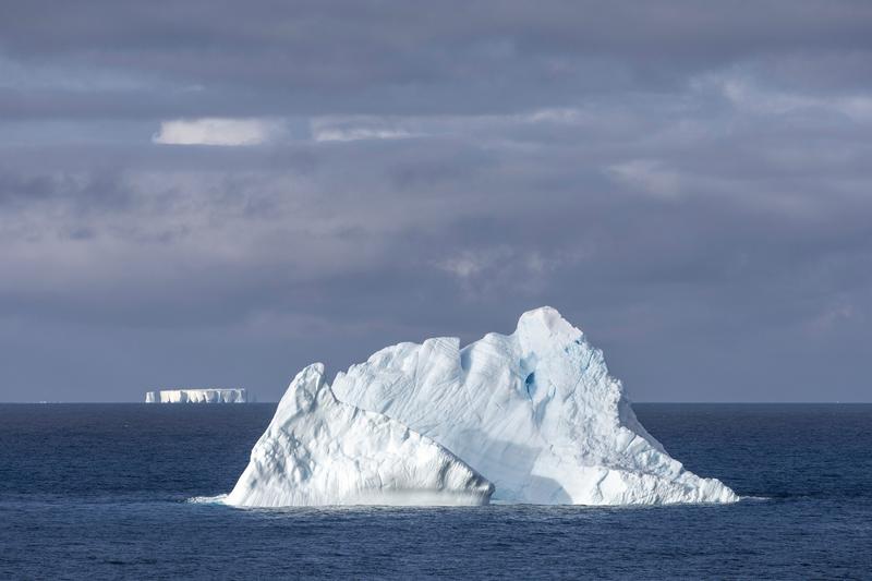
A weathered iceberg with a ridged crest floats in deep blue water, a long tabular berg on the horizon behind it, Phantom Coast, Marie Byrd Land, the Ross Sea.
✎ This text is the AI Caption. It is the only thing written into Canto.
84Phantom Coast, Marie Byrd Land highSunlit berg against grey cloud, tabular berg behind gives depth · from GPS
Day15-22_PhantomCoast_RichardSidey-20.jpg
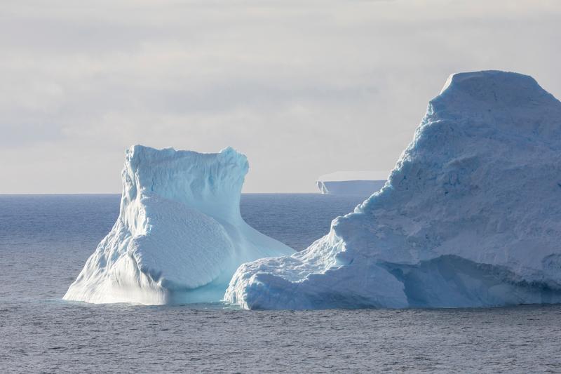
Two large eroded icebergs stand close together on a grey sea, a flat tabular berg small on the horizon between them, Phantom Coast, Marie Byrd Land, the Ross Sea.
✎ This text is the AI Caption. It is the only thing written into Canto.
84Phantom Coast, Marie Byrd Land highLayered bergs with a distant tabular for depth; soft even light · from GPS
Day15-22_PhantomCoast_RichardSidey-19.jpg
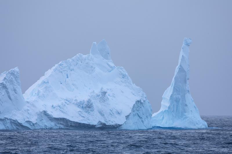
Two pinnacled icebergs, one a tall thin spire, stand in cold mist above a dark sea, Phantom Coast, Marie Byrd Land, the Ross Sea.
✎ This text is the AI Caption. It is the only thing written into Canto.
84Phantom Coast, Marie Byrd Land highBlue tones and the spire shape make it the most graphic berg pair
Day15-22_PhantomCoast_RichardSidey-35.jpg
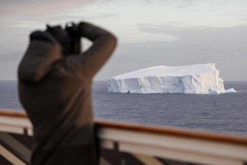
A guest silhouetted at the ship's rail glasses a large tabular iceberg with binoculars in soft evening light, Phantom Coast, Marie Byrd Land, the Ross Sea.
✎ This text is the AI Caption. It is the only thing written into Canto.
84Phantom Coast, Marie Byrd Land highDark foreground figure frames the lit berg; the watching moment reads clearly
Day15-22_PhantomCoast_RichardSidey-37.jpg
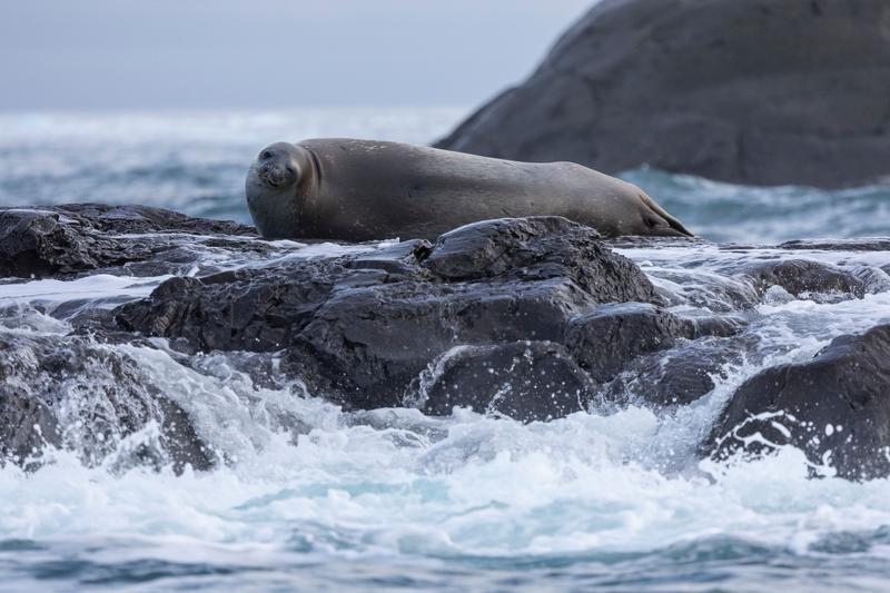
A seal rests on wave-washed black rock with surf breaking around the ledge below it, Walgreen Coast, Amundsen Sea, the Ross Sea.
✎ This text is the AI Caption. It is the only thing written into Canto.
84Walgreen Coast, Amundsen Sea highRocky surf-washed haulout, not fast ice; species left plain, head shape ambiguous · from GPS
Day23_PeterØy_RichardSidey-3.jpg
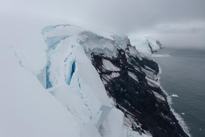
An aerial along a snow-capped headland where a glacier edge breaks over dark red-brown volcanic rock into the sea, Walgreen Coast, Amundsen Sea, the Ross Sea.
✎ This text is the AI Caption. It is the only thing written into Canto.
84Walgreen Coast, Amundsen Sea highRed volcanic rock against fractured ice edge; moody low cloud · from GPS
Day23_PeterØy_RichardSidey-9.jpg
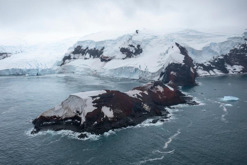
An aerial of a red-brown volcanic islet in the foreground with a glaciated coast and ice cliffs behind it, Walgreen Coast, Amundsen Sea, the Ross Sea.
✎ This text is the AI Caption. It is the only thing written into Canto.
84Walgreen Coast, Amundsen Sea highRed rock against blue-white ice, layered depth; site not identifiable · from GPS
Day23_PeterØy_RichardSidey-12.jpg
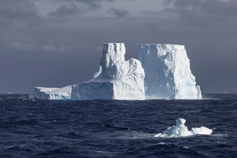
A large iceberg with two blocky summits sits on a dark running sea, a small berg in the foreground swell, Phantom Coast, Marie Byrd Land, the Ross Sea.
✎ This text is the AI Caption. It is the only thing written into Canto.
84Phantom Coast, Marie Byrd Land highSimilar berg from another side; darker sky, foreground berg adds depth
Day15-22_PhantomCoast_RichardSidey-95.jpg
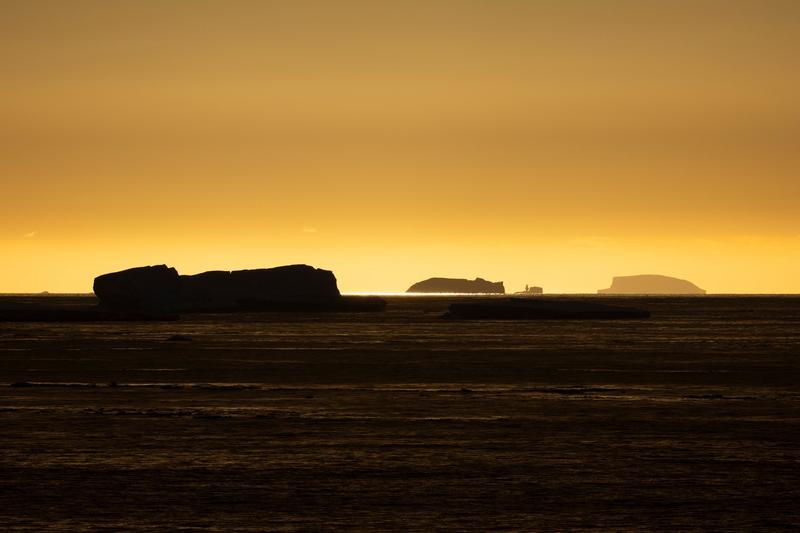
Tabular icebergs and flat floes stand in silhouette on a gold sea under a low midnight sun, Cape Adare, the Ross Sea.
✎ This text is the AI Caption. It is the only thing written into Canto.
83Cape Adare highMinimal graphic silhouette study; sustained warm band across the frame · from GPS
Day8_CapeAdare_RichardSidey-2.jpg
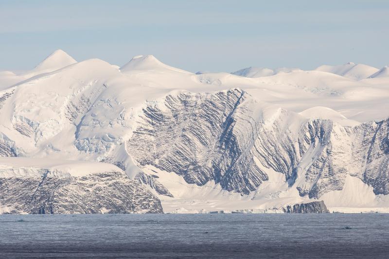
A wall of heavily glaciated peaks and ice-filled valleys runs along the coast above a dark sea, Cape Adare, the Ross Sea.
✎ This text is the AI Caption. It is the only thing written into Canto.
83Cape Adare highClean high-contrast range with ice cliffs at sea level; no nameable peak · from GPS
Day8_CapeAdare_RichardSidey-23.jpg
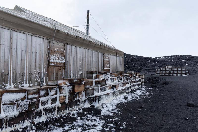
The weathered timber flank of a preserved expedition hut runs back to black volcanic ground, provision crates stacked and iced along its wall, Cape Royds, the Ross Sea.
✎ This text is the AI Caption. It is the only thing written into Canto.
83Cape Royds highHistoric hut exterior on scoria; nothing in frame names which hut · from GPS
Day10_CapeRoyds_RichardSidey-7.jpg
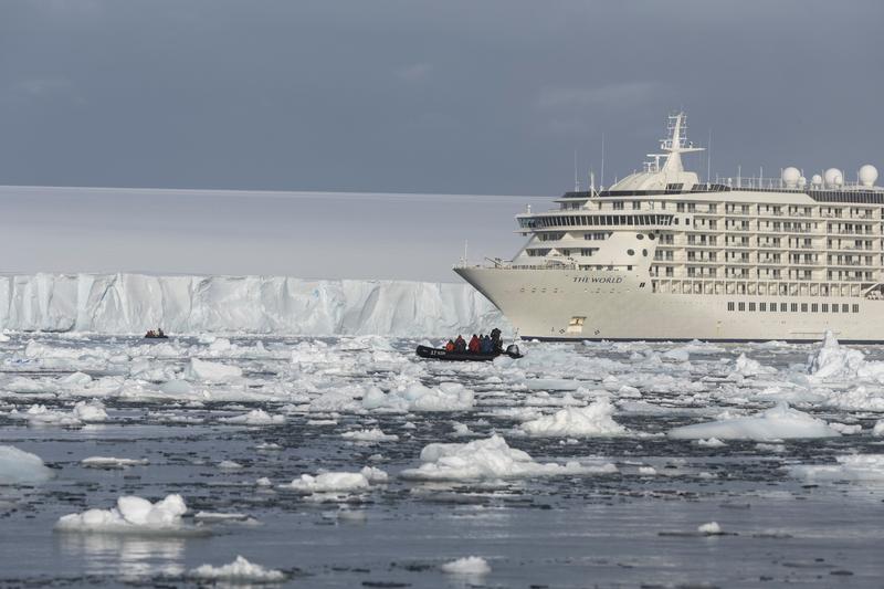
Two zodiacs of passengers work through loose brash ice in front of a long ice cliff, with an expedition cruise ship holding station behind them, Bartlett Inlet, Ross Ice Shelf, the Ross Sea.
✎ This text is the AI Caption. It is the only thing written into Canto.
83Bartlett Inlet, Ross Ice Shelf highBow name is the vessel; low flat ice cliff and heavy brash fill the scene · from GPS
Day14_BartlettInlet_RichardSidey-8.jpg
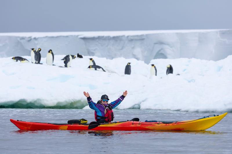
A kayaker raises both arms in a sea kayak with a group of emperor penguins standing on the floe behind, Bartlett Inlet, Ross Ice Shelf, the Ross Sea.
✎ This text is the AI Caption. It is the only thing written into Canto.
83Bartlett Inlet, Ross Ice Shelf highNear sibling of the paddle-raised frame; more penguins but same posed moment · from GPS
Day14_BartlettInlet_RichardSidey-25.jpg
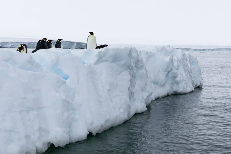
Emperor penguins stand at the lip of a thick floe that drops straight into dark water, with a low ice front on the horizon, Bartlett Inlet, Ross Ice Shelf, the Ross Sea.
✎ This text is the AI Caption. It is the only thing written into Canto.
83Bartlett Inlet, Ross Ice Shelf highBirds on the floe edge with blue ice below; good context, flat overcast light · from GPS
Day14_BartlettInlet_RichardSidey-26.jpg
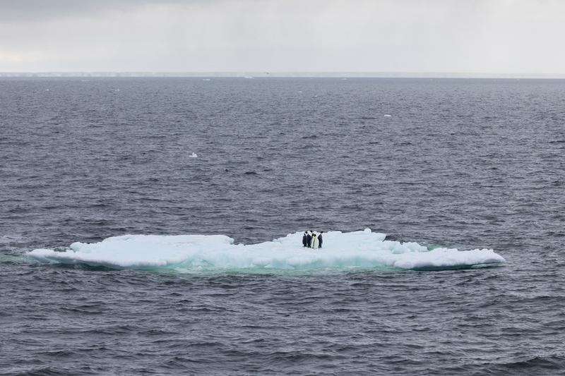
Four emperor penguins stand together on a single flat floe surrounded by open grey sea, with a distant ice front on the horizon, Bay of Whales, Ross Ice Shelf, the Ross Sea.
✎ This text is the AI Caption. It is the only thing written into Canto.
83Bay of Whales, Ross Ice Shelf highIsolation and scale read well; subject very small and light is flat · from GPS
Day13_BayOfWhales_RichardSidey-7.jpg
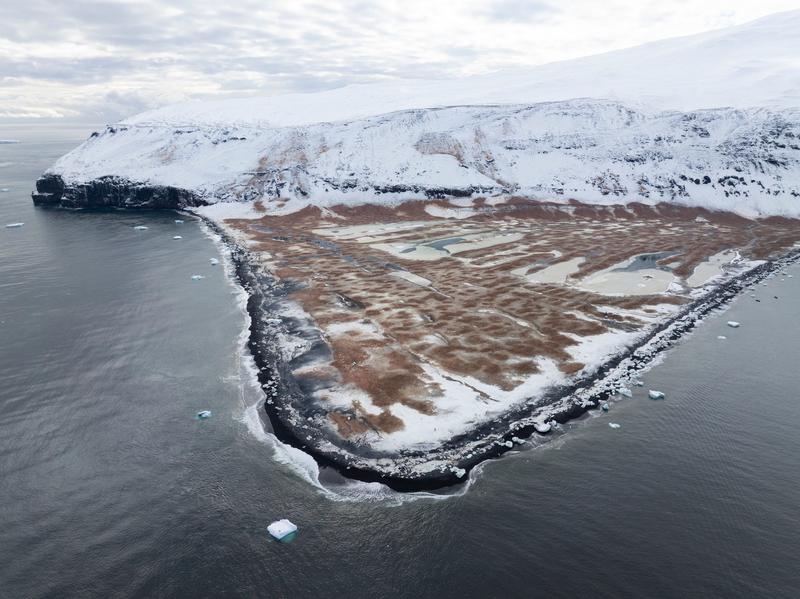
An aerial view of a broad triangular gravel spit stained rust brown by a penguin colony, with meltwater ponds and a black surf-washed shoreline, likely Cape Adare, the Ross Sea.
✎ This text is the AI Caption. It is the only thing written into Canto.
82Cape Adare mediumSame guano-stained spit under the headland as the hut aerials
Day8_CapeAdare_RichardSidey-14.jpg
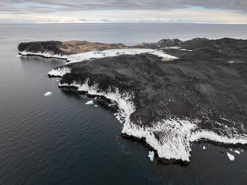
An aerial view along a black volcanic cape with a single small building at the edge of a snowfield and a distant mountain range across the water, Cape Royds, the Ross Sea.
✎ This text is the AI Caption. It is the only thing written into Canto.
82Cape Royds highVolcanic cape with a hut and a range across a sound; not nameable from pixels · from GPS
Day10_CapeRoyds_RichardSidey-19.jpg
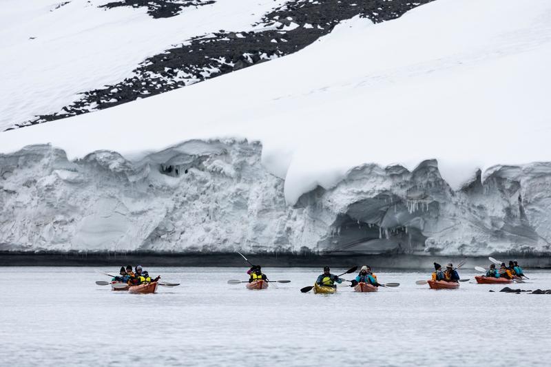
Six sea kayaks paddle in line along a low ice foot undercut into caves below a snow slope, Cape Royds, the Ross Sea.
✎ This text is the AI Caption. It is the only thing written into Canto.
82Cape Royds highKayaks small under the ice wall, good scale; flat overcast light · from GPS
Day10_CapeRoyds_RichardSidey-17.jpg
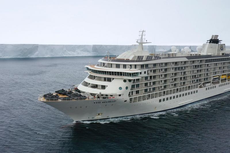
An expedition cruise ship approaches bow on through dark water, with a flat ice shelf cliff running level to the horizon behind it, Ross Ice Shelf, the Ross Sea.
✎ This text is the AI Caption. It is the only thing written into Canto.
82Ross Ice Shelf highBow lettering is the vessel name; ice cliff to horizon reads ice shelf
Day12_RossIceShelf_RichardSidey-5.jpg
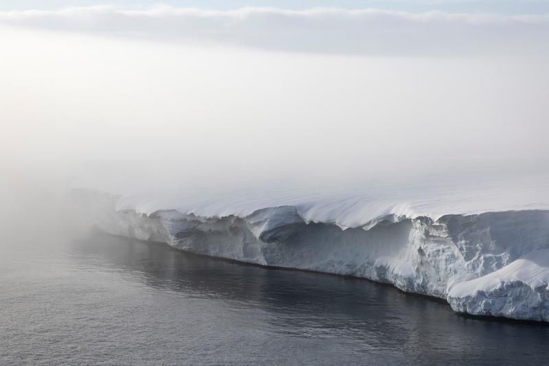
Mist drifts along the face of a tall ice cliff whose flat top runs out of frame, the sea dark at its foot, Bartlett Inlet, Ross Ice Shelf, the Ross Sea.
✎ This text is the AI Caption. It is the only thing written into Canto.
82Bartlett Inlet, Ross Ice Shelf highWind-carved cornice and sheer face of a large flat-topped ice front in fog · from GPS
Day14_BartlettInlet_RichardSidey-5.jpg
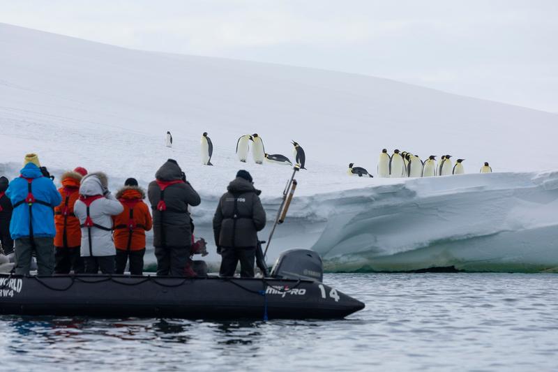
Passengers stand in a zodiac photographing a group of emperor penguins gathered on the edge of a floe a few metres away, Bartlett Inlet, Ross Ice Shelf, the Ross Sea.
✎ This text is the AI Caption. It is the only thing written into Canto.
82Bartlett Inlet, Ross Ice Shelf highGuest-experience frame; tube lettering is the mother vessel and boat number, not a place · from GPS
Day14_BartlettInlet_RichardSidey-17.jpg
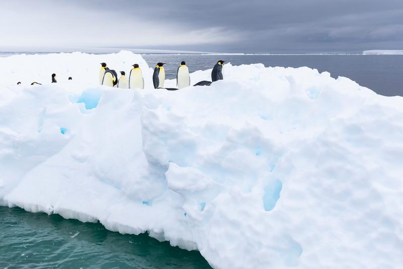
Emperor penguins gather on a broad floe with pockets of blue ice, a heavy cloud bank and a distant ice front behind them, Bartlett Inlet, Ross Ice Shelf, the Ross Sea.
✎ This text is the AI Caption. It is the only thing written into Canto.
82Bartlett Inlet, Ross Ice Shelf highSibling of the previous floe-top frame; foreground ice takes most of the picture · from GPS
Day14_BartlettInlet_RichardSidey-30.jpg
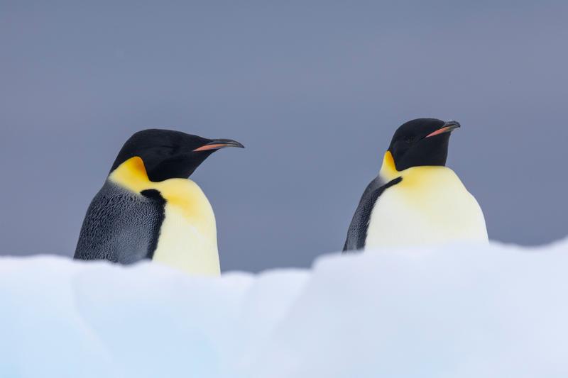
Two emperor penguins stand facing away from each other on a snow ridge against a plain grey sky, Bartlett Inlet, Ross Ice Shelf, the Ross Sea.
✎ This text is the AI Caption. It is the only thing written into Canto.
82Bartlett Inlet, Ross Ice Shelf highClean symmetrical pair on a grey ground; bodies cut off at the snow line · from GPS
Day14_BartlettInlet_RichardSidey-32.jpg
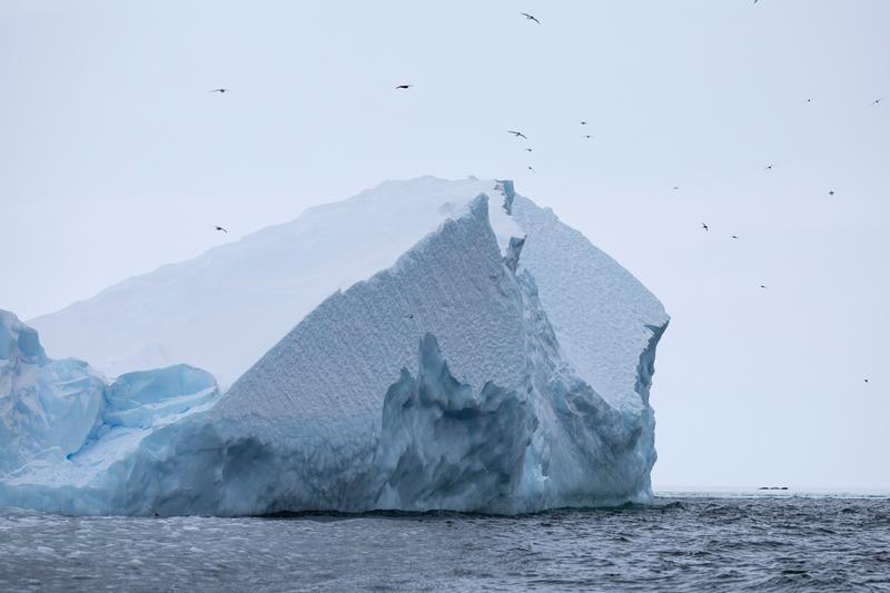
Petrels wheel in numbers around a large fractured iceberg rising from grey open water, Bay of Whales, Ross Ice Shelf, the Ross Sea.
✎ This text is the AI Caption. It is the only thing written into Canto.
82Bay of Whales, Ross Ice Shelf highBirds give the berg scale and life; too distant to call the species · from GPS
Day13_BayOfWhales_RichardSidey-11.jpg
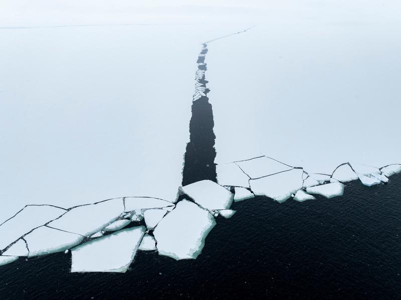
An aerial abstract of a dark lead splitting a white sheet of sea ice, with broken plates along the open water margin, Bay of Whales, Ross Ice Shelf, the Ross Sea.
✎ This text is the AI Caption. It is the only thing written into Canto.
82Bay of Whales, Ross Ice Shelf highGraphic black and white ice study; no place evidence at all · from GPS
Day13_BayOfWhales_RichardSidey-40.jpg
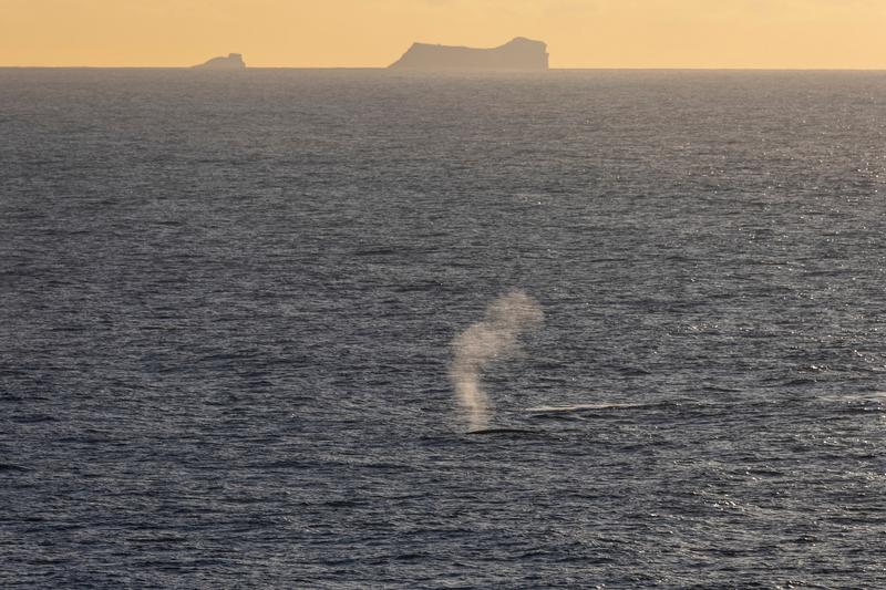
A large whale blows at the surface in golden evening light, a steep tabular headland silhouetted on the horizon behind, Phantom Coast, Marie Byrd Land, the Ross Sea.
✎ This text is the AI Caption. It is the only thing written into Canto.
82Phantom Coast, Marie Byrd Land highBlow and back only, species not resolvable; headland is distant, not our position · from GPS
Day15-22_PhantomCoast_RichardSidey-16.jpg
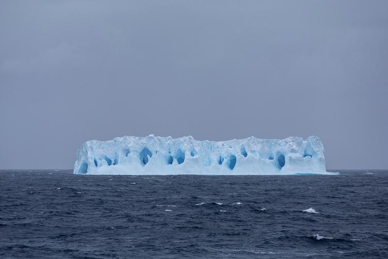
A low tabular iceberg riddled with blue melt caves lies on a wind-chopped sea under flat grey cloud, Phantom Coast, Marie Byrd Land, the Ross Sea.
✎ This text is the AI Caption. It is the only thing written into Canto.
82Phantom Coast, Marie Byrd Land highRow of blue caves along the whole face; centred and symmetrical
Day15-22_PhantomCoast_RichardSidey-33.jpg
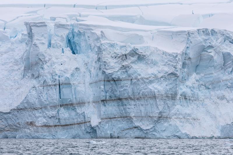
The face of a glacier meeting the sea, banded with dark sediment layers and split by blue crevasses, Walgreen Coast, Amundsen Sea, the Ross Sea.
✎ This text is the AI Caption. It is the only thing written into Canto.
82Walgreen Coast, Amundsen Sea highDirt bands in the ice are unusual and give the wall its structure · from GPS
Day23_PeterØy_RichardSidey-5.jpg
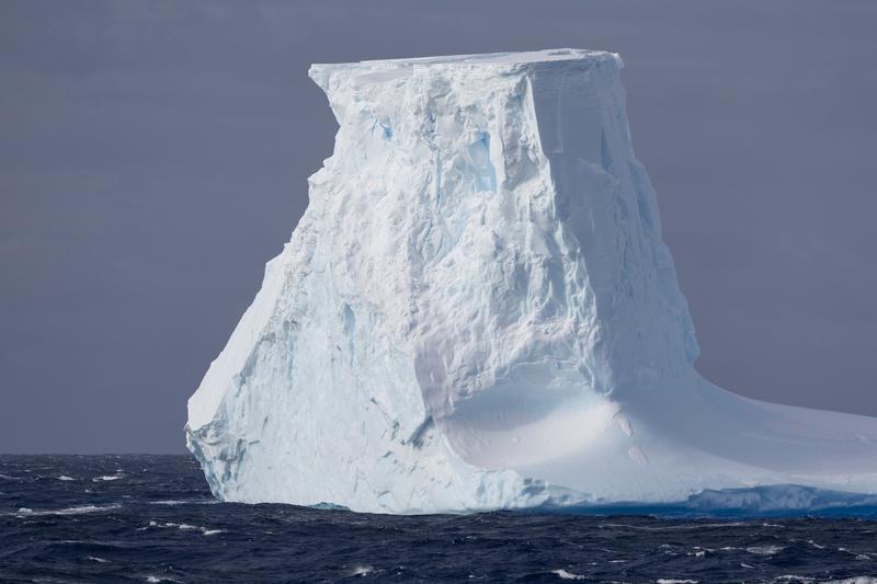
A blocky iceberg with a smooth scooped flank and a flat top sits alone on a dark choppy sea, Phantom Coast, Marie Byrd Land, the Ross Sea.
✎ This text is the AI Caption. It is the only thing written into Canto.
82Phantom Coast, Marie Byrd Land highSimple single-berg study, grey sky, less interesting than its neighbours
Day15-22_PhantomCoast_RichardSidey-97.jpg
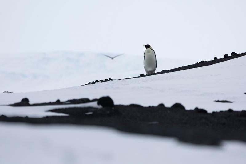
An emperor penguin stands on a snow slope streaked with dark volcanic rock as a bird passes behind it in flight, Cape Evans, the Ross Sea.
✎ This text is the AI Caption. It is the only thing written into Canto.
81Cape Evans highYellow ear and neck wash read emperor; flying bird too blurred to name · from GPS
Day11_CapeEvans_RichardSidey-8.jpg
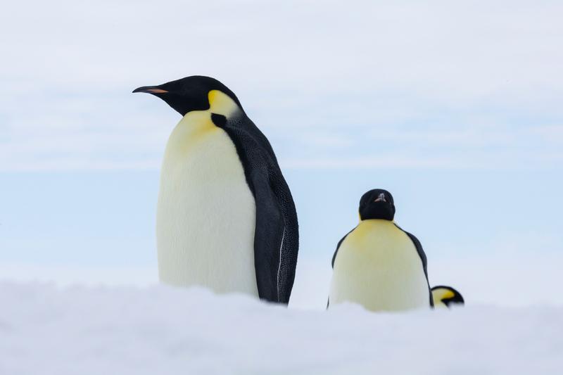
Two emperor penguins stand close together on a snow rise, a third bird just visible behind them, Bartlett Inlet, Ross Ice Shelf, the Ross Sea.
✎ This text is the AI Caption. It is the only thing written into Canto.
81Bartlett Inlet, Ross Ice Shelf highClean pale study of adults; birds cut off at the snow line · from GPS
Day14_BartlettInlet_RichardSidey-21.jpg
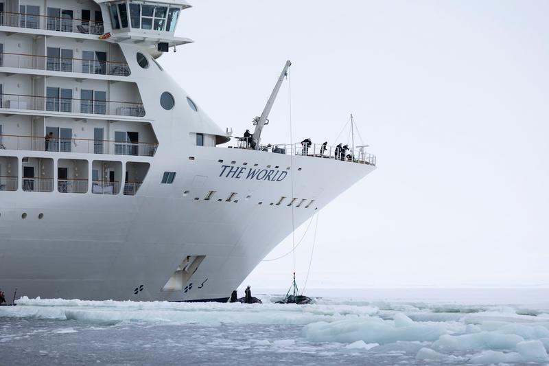
Crew work a deck crane on the foredeck of an expedition cruise ship, lowering a line to a small boat in the brash ice under the bow, Bay of Whales, Ross Ice Shelf, the Ross Sea.
✎ This text is the AI Caption. It is the only thing written into Canto.
81Bay of Whales, Ross Ice Shelf highOperational moment with real crew work; bow lettering is the vessel name only · from GPS
Day13_BayOfWhales_RichardSidey-10.jpg
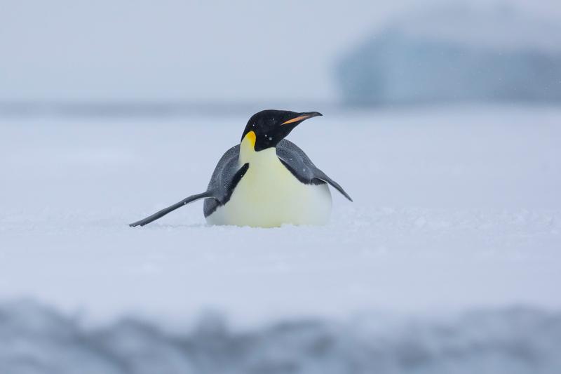
An emperor penguin lies flat on the ice with its head raised and bill open, a pale iceberg behind, Bay of Whales, Ross Ice Shelf, the Ross Sea.
✎ This text is the AI Caption. It is the only thing written into Canto.
81Bay of Whales, Ross Ice Shelf highSibling of the lying pair; single bird, less to hold the frame · from GPS
Day13_BayOfWhales_RichardSidey-25.jpg
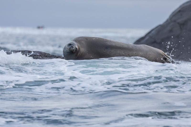
A seal lies on a low rock shelf as white water washes over it, a dark boulder behind, Walgreen Coast, Amundsen Sea, the Ross Sea.
✎ This text is the AI Caption. It is the only thing written into Canto.
81Walgreen Coast, Amundsen Sea highSame animal as its sibling frame, tighter and lower; species not asserted · from GPS
Day23_PeterØy_RichardSidey-2.jpg
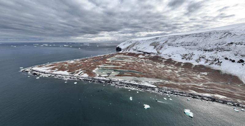
A wide aerial panorama of a rust-brown ice-free spit with meltwater ponds at the foot of a snow-covered cliff, ice floes scattered offshore, likely Cape Adare, the Ross Sea.
✎ This text is the AI Caption. It is the only thing written into Canto.
80Cape Adare mediumSame triangular guano-stained spit under a headland as the hut aerial
Day8_CapeAdare_RichardSidey-12.jpg
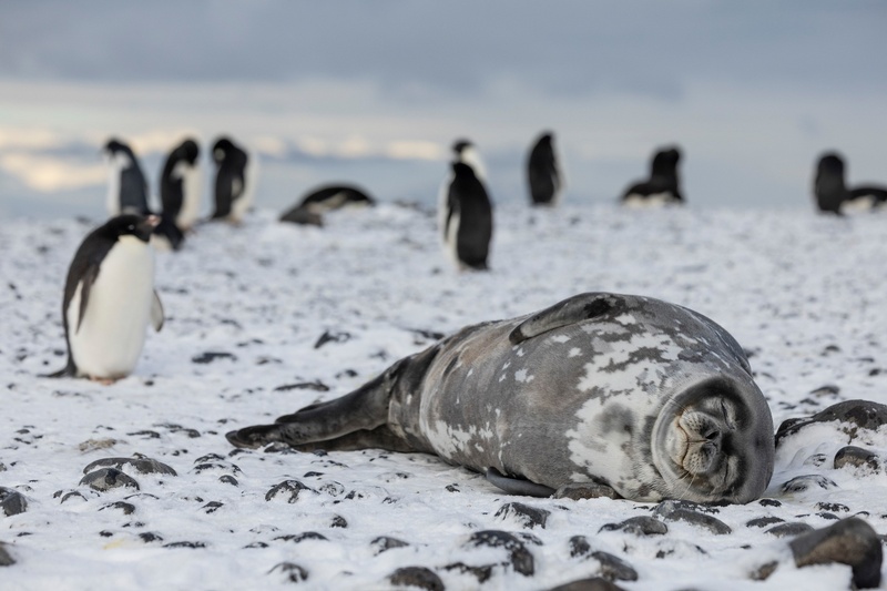
A Weddell seal sleeps on snow-covered stones with Adelie penguins standing behind it, Cape Adare, the Ross Sea.
✎ This text is the AI Caption. It is the only thing written into Canto.
80Cape Adare highBlunt upturned muzzle and mottled silver coat identify Weddell seal · from GPS
Day8_CapeAdare_RichardSidey-9.jpg
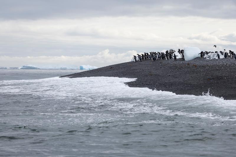
Adelie penguins line the crest of a black gravel spit as surf runs up the beach, with icebergs on the horizon.
✎ This text is the AI Caption. It is the only thing written into Canto.
80Cape Adare lowSame black spit and offshore bergs as the colony frames; weak hint only
Day8_CapeAdare_RichardSidey-19.jpg
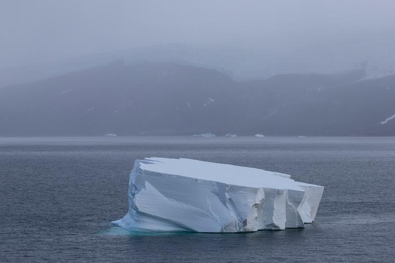
A sharply ridged tabular iceberg sits in still water below a dark snow-streaked hillside lost in mist, Cape Royds, the Ross Sea.
✎ This text is the AI Caption. It is the only thing written into Canto.
80Cape Royds highCold muted palette, clean separation of berg and coast; coastline unidentifiable
Day10_CapeRoyds_RichardSidey-2.jpg
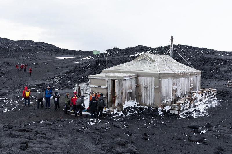
Visitors in parkas gather at the door of a preserved expedition hut standing on a field of black volcanic rock, Cape Royds, the Ross Sea.
✎ This text is the AI Caption. It is the only thing written into Canto.
80Cape Royds highWhole hut in frame with people for scale; site sign too distant to read · from GPS
Day10_CapeRoyds_RichardSidey-5.jpg
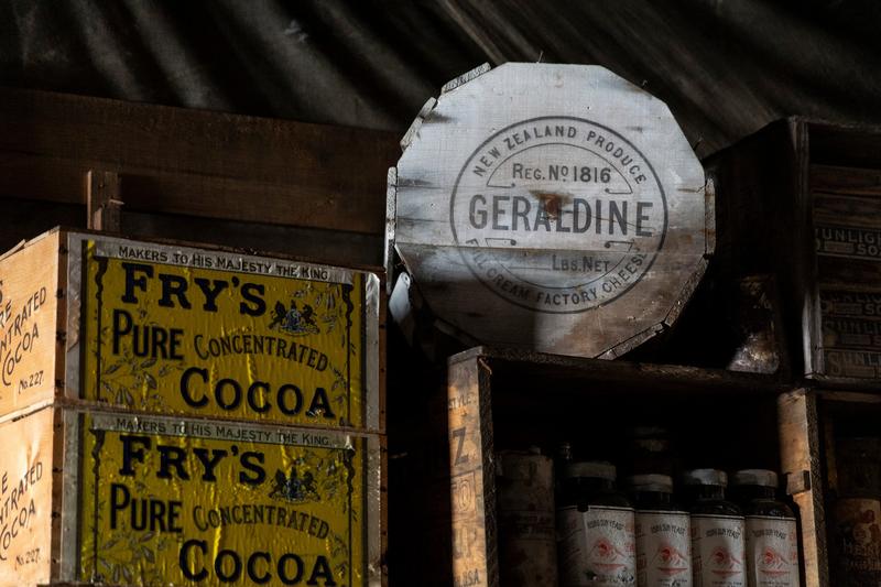
Stacked provision crates and bottles inside a preserved expedition hut, with printed cocoa cases, a round cheese case and a shelf of yeast bottles under the dark timber roof, Cape Evans, the Ross Sea.
✎ This text is the AI Caption. It is the only thing written into Canto.
80Cape Evans highBrand and produce marks on crates, not a location; hut site not nameable · from GPS
Day11_CapeEvans_RichardSidey-11.jpg
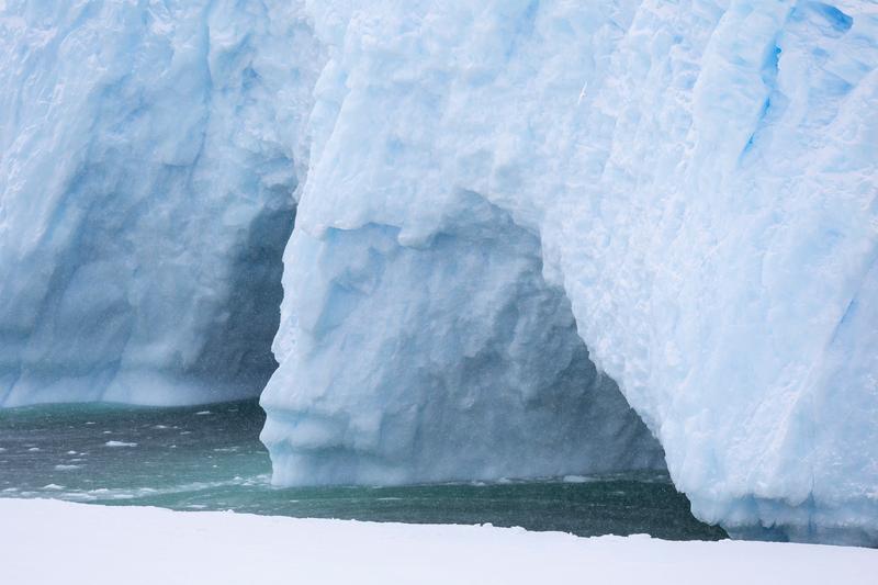
Snow falls across the buttressed face of a large iceberg where a dark cavern is undercut at the waterline, Bay of Whales, Ross Ice Shelf, the Ross Sea.
✎ This text is the AI Caption. It is the only thing written into Canto.
80Bay of Whales, Ross Ice Shelf highFalling snow and the undercut arch give depth; no scale reference in frame · from GPS
Day13_BayOfWhales_RichardSidey-8.jpg
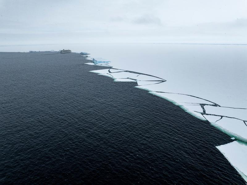
An aerial along the fast ice edge, fracture lines running back into the sheet, a ship standing off in the distance, Bay of Whales, Ross Ice Shelf, the Ross Sea.
✎ This text is the AI Caption. It is the only thing written into Canto.
80Bay of Whales, Ross Ice Shelf highLong curving ice edge gives scale; ship too small to carry the frame · from GPS
Day13_BayOfWhales_RichardSidey-39.jpg
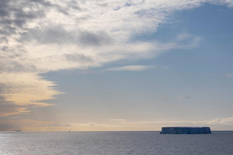
A flat-topped iceberg sits on a calm sea under a wide sky of high cloud, more ice barely visible on the far horizon, Phantom Coast, Marie Byrd Land, the Ross Sea.
✎ This text is the AI Caption. It is the only thing written into Canto.
80Phantom Coast, Marie Byrd Land highSky dominant with the berg placed low right; quiet and clean
Day15-22_PhantomCoast_RichardSidey-22.jpg
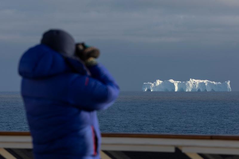
A guest in a blue parka photographs a long tabular iceberg from the ship's rail, the berg sharp behind the out of focus figure, Phantom Coast, Marie Byrd Land, the Ross Sea.
✎ This text is the AI Caption. It is the only thing written into Canto.
80Phantom Coast, Marie Byrd Land highForeground figure is soft by design; tells the watching-from-deck story · from GPS
Day15-22_PhantomCoast_RichardSidey-17.jpg
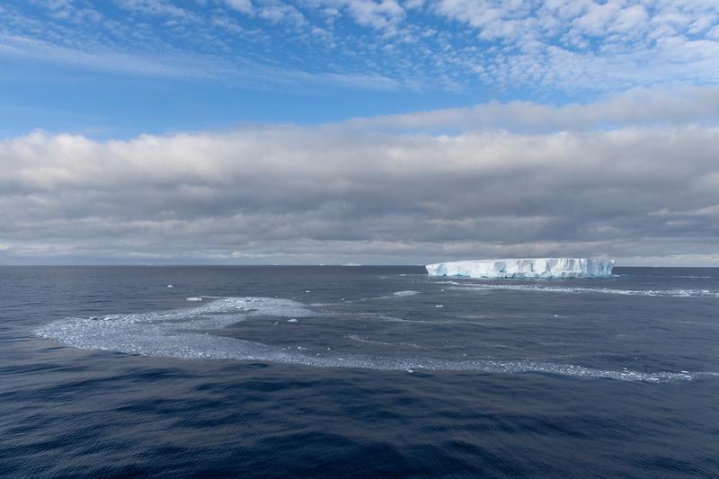
A long tabular iceberg sits on the horizon beyond a curving band of brash ice on open water, Phantom Coast, Marie Byrd Land, the Ross Sea.
✎ This text is the AI Caption. It is the only thing written into Canto.
80Phantom Coast, Marie Byrd Land highSweeping brash line leads to the berg; big open sky
Day15-22_PhantomCoast_RichardSidey-26.jpg
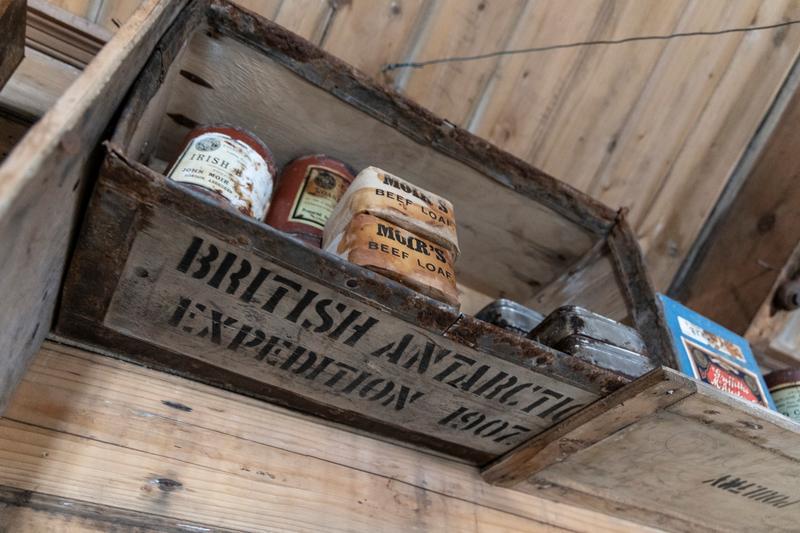
A stencilled timber provision crate on a hut shelf still holds rusted tins of beef loaf and glass jars, Cape Royds, the Ross Sea.
✎ This text is the AI Caption. It is the only thing written into Canto.
79Cape Royds highCrate stencil is an object and an expedition name, not a place; left unplaced · from GPS
Day10_CapeRoyds_RichardSidey-8.jpg
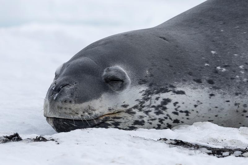
A seal dozes with its head resting on snow, dark spots scattered across its pale throat, Cape Royds, the Ross Sea.
✎ This text is the AI Caption. It is the only thing written into Canto.
79Cape Royds highTight head crop; spotting suggests leopard but head shape reads Weddell · from GPS
Day10_CapeRoyds_RichardSidey-13.jpg
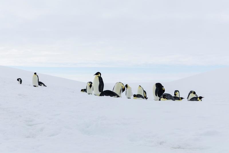
A loose group of emperor penguins stands and lies on a broad snow slope under flat white cloud, Bartlett Inlet, Ross Ice Shelf, the Ross Sea.
✎ This text is the AI Caption. It is the only thing written into Canto.
79Bartlett Inlet, Ross Ice Shelf highGroup in a wide white field; flat light gives little separation · from GPS
Day14_BartlettInlet_RichardSidey-22.jpg
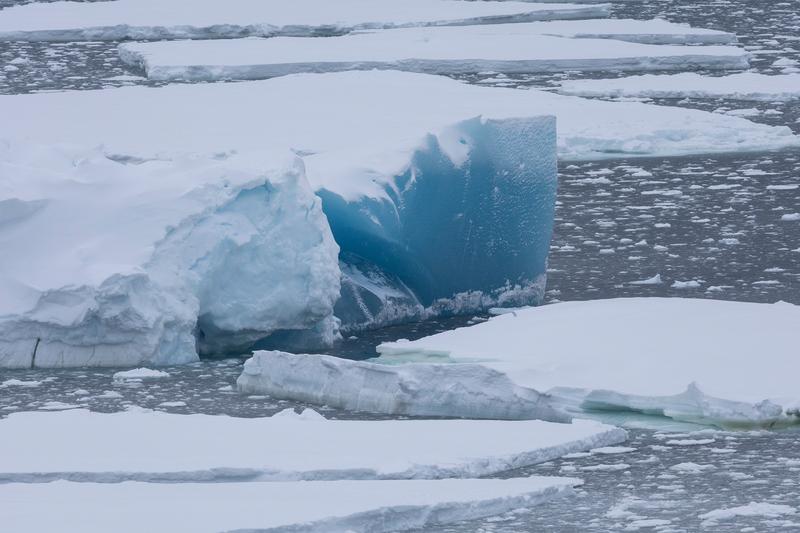
A wedge of deep blue rolled ice sits among flat white floes on grey water, likely Bay of Whales, Ross Ice Shelf, the Ross Sea.
✎ This text is the AI Caption. It is the only thing written into Canto.
79Bay of Whales, Ross Ice Shelf mediumSame blue-ice subject seen wider; colour holds but composition is looser · from GPS
Day13_BayOfWhales_RichardSidey-4.jpg
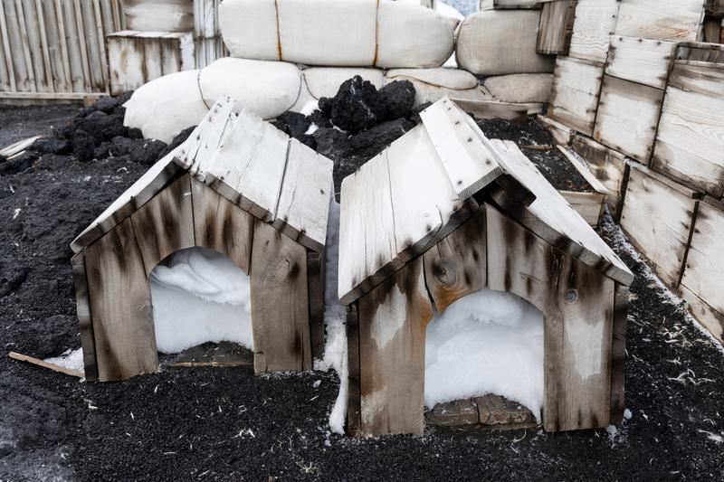
Two small timber dog kennels half filled with drifted snow sit on black volcanic gravel beside stacked provision crates and canvas-wrapped bales, Cape Royds, the Ross Sea.
✎ This text is the AI Caption. It is the only thing written into Canto.
78Cape Royds highHistoric-site detail outside a hut; no evidence naming which site · from GPS
Day10_CapeRoyds_RichardSidey-6.jpg
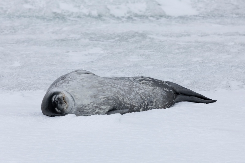
A Weddell seal lies asleep on snow, its silver-mottled flank turned to the light, Cape Royds, the Ross Sea.
✎ This text is the AI Caption. It is the only thing written into Canto.
78Cape Royds highSmall head, short muzzle and silver mottling identify Weddell seal
Day10_CapeRoyds_RichardSidey-12.jpg
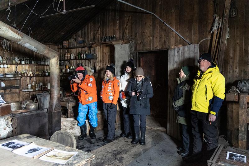
Six visitors in expedition parkas stand inside a preserved hut, one photographing the shelves of bottles and stores, with archive prints laid out on the table in front of them, Cape Evans, the Ross Sea.
✎ This text is the AI Caption. It is the only thing written into Canto.
78Cape Evans highLarger hut than the stove room; table prints are pictures, not place evidence
Day11_CapeEvans_RichardSidey-6.jpg
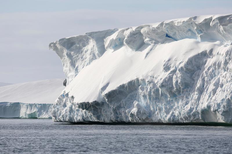
Sunlight rakes across the sculpted end of a large tabular iceberg hung with icicles, with more flat-topped ice stretching away behind it, Bartlett Inlet, Ross Ice Shelf, the Ross Sea.
✎ This text is the AI Caption. It is the only thing written into Canto.
78Bartlett Inlet, Ross Ice Shelf highBig tabular ice face in hard light; no scale reference and no place signal
Day14_BartlettInlet_RichardSidey-15.jpg
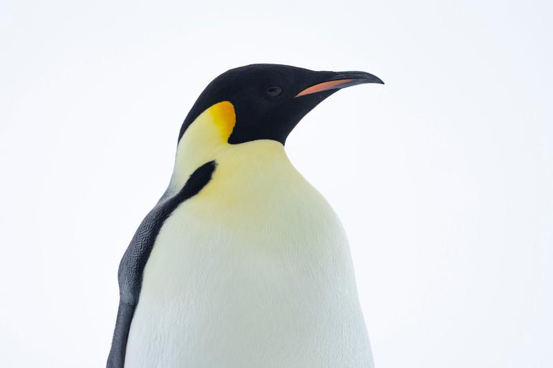
A head and shoulders study of an emperor penguin against plain white, showing the orange ear patch and yellow neck wash, Bartlett Inlet, Ross Ice Shelf, the Ross Sea.
✎ This text is the AI Caption. It is the only thing written into Canto.
78Bartlett Inlet, Ross Ice Shelf highTight portrait with no environment; sharp but a closeup on nothing per the rubric · from GPS
Day14_BartlettInlet_RichardSidey-27.jpg
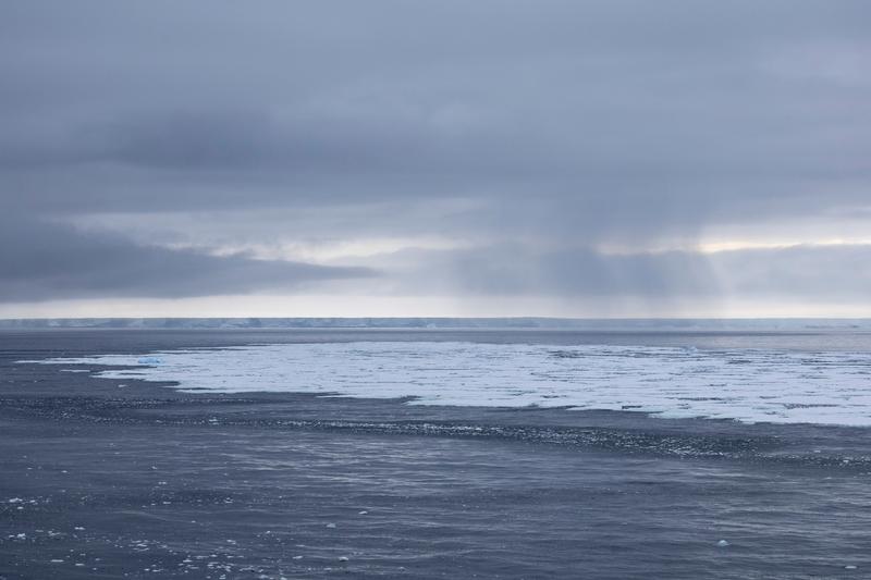
Fingers of loose ice lie on dark water below a bank of falling snow, with a line of flat-topped icebergs along the horizon, likely Bay of Whales, Ross Ice Shelf, the Ross Sea.
✎ This text is the AI Caption. It is the only thing written into Canto.
78Bay of Whales, Ross Ice Shelf mediumWeather and light are the subject; long line of tabular bergs sets the region · from GPS
Day13_BayOfWhales_RichardSidey-6.jpg
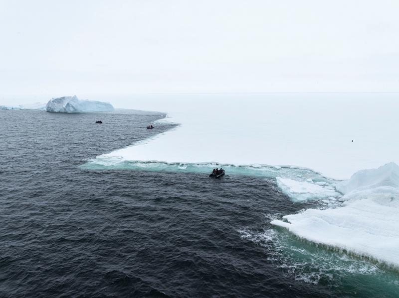
Zodiacs cruise the ragged margin where open water meets an unbroken sheet of sea ice running to the horizon, Bay of Whales, Ross Ice Shelf, the Ross Sea.
✎ This text is the AI Caption. It is the only thing written into Canto.
78Bay of Whales, Ross Ice Shelf highIce edge scale is good but the light is flat and the boats are tiny · from GPS
Day13_BayOfWhales_RichardSidey-42.jpg
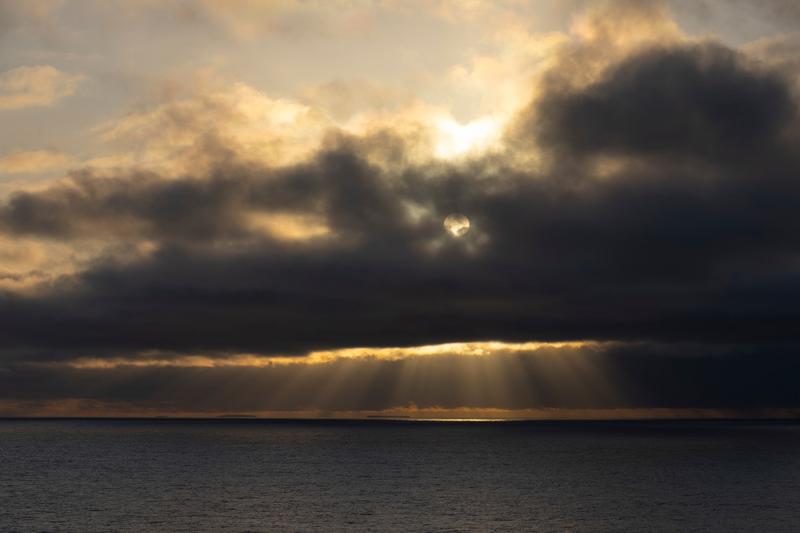
Low sun burns through a break in a heavy cloud deck and throws rays down onto a dark, calm sea, Phantom Coast, Marie Byrd Land, the Ross Sea.
✎ This text is the AI Caption. It is the only thing written into Canto.
78Phantom Coast, Marie Byrd Land highPure sky and sea study, no ice or subject to anchor it · from GPS
Day15-22_PhantomCoast_RichardSidey-13.jpg
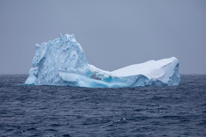
A pinnacled iceberg with a long sloping shoulder floats in flat light on a dark grey sea, Phantom Coast, Marie Byrd Land, the Ross Sea.
✎ This text is the AI Caption. It is the only thing written into Canto.
78Phantom Coast, Marie Byrd Land highGood berg shape but the light is dull and the sky is empty
Day15-22_PhantomCoast_RichardSidey-34.jpg
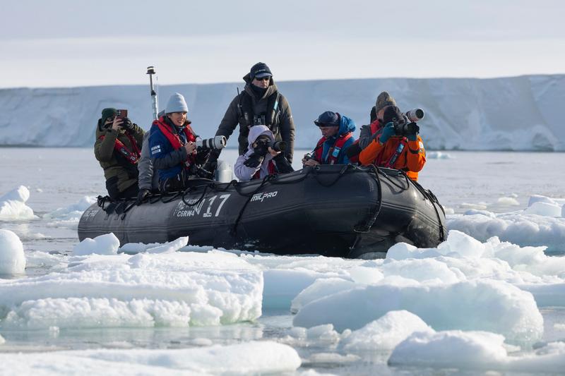
Six passengers in a numbered zodiac photograph with long lenses and phones while the boat sits in loose brash ice below a flat ice cliff, Bartlett Inlet, Ross Ice Shelf, the Ross Sea.
✎ This text is the AI Caption. It is the only thing written into Canto.
77Bartlett Inlet, Ross Ice Shelf highNumerals and tube brand are boat markings, not a place; documentary rather than hero · from GPS
Day14_BartlettInlet_RichardSidey-12.jpg
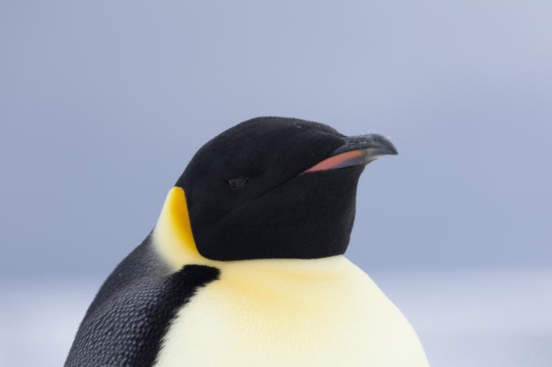
A close portrait of an emperor penguin with its bill tilted up, the black hood, orange ear patch and yellow breast wash filling the frame, Bartlett Inlet, Ross Ice Shelf, the Ross Sea.
✎ This text is the AI Caption. It is the only thing written into Canto.
77Bartlett Inlet, Ross Ice Shelf highVery sharp but a tight headshot with no environment; capped per the rubric · from GPS
Day14_BartlettInlet_RichardSidey-31.jpg
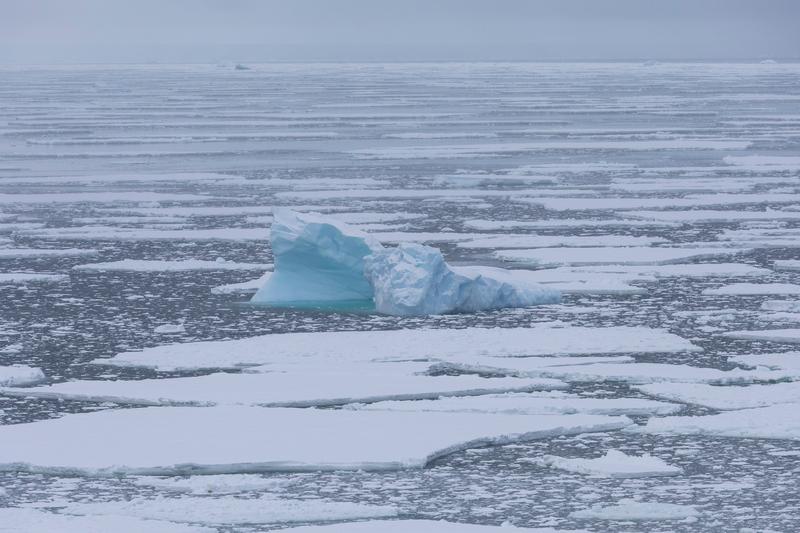
A small blue growler stands up out of a wide field of flat pack ice under grey cloud, likely Bay of Whales, Ross Ice Shelf, the Ross Sea.
✎ This text is the AI Caption. It is the only thing written into Canto.
77Bay of Whales, Ross Ice Shelf mediumOne blue form against endless white; simple and clean but flat light · from GPS
Day13_BayOfWhales_RichardSidey-5.jpg
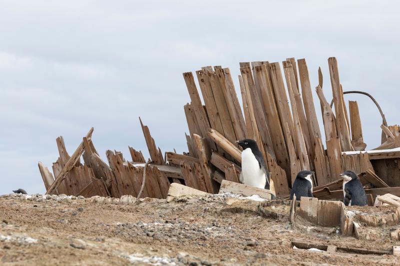
Adelie penguins stand among the collapsed timber planking and rope of an old structure on a gravel ridge.
✎ This text is the AI Caption. It is the only thing written into Canto.
76Cape Adare lowTimber ruin inside the same Adelie colony as the hut frames; weak on its own
Day8_CapeAdare_RichardSidey-10.jpg
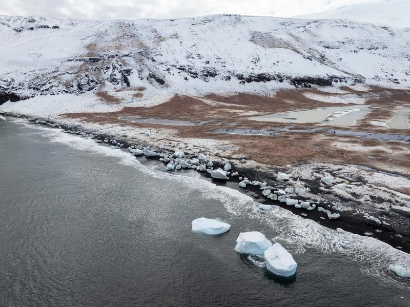
An aerial view along a black beach where grounded ice blocks line the surf below a brown penguin colony and snow-covered slopes.
✎ This text is the AI Caption. It is the only thing written into Canto.
76Cape Adare lowSame colony terrace and shoreline seen from lower and closer
Day8_CapeAdare_RichardSidey-17.jpg
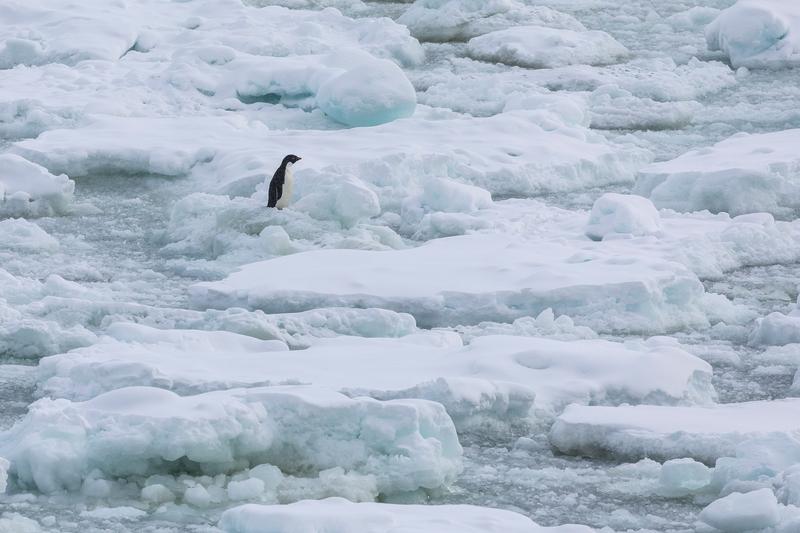
A single Adelie penguin stands on rafted sea ice among snow-covered floes.
✎ This text is the AI Caption. It is the only thing written into Canto.
76Terra Nova Bay ice edge lowSmall dark subject isolated in a pale ice field; strong minimalism, low contrast
Day9_IceEdge_RichardSidey-5.jpg
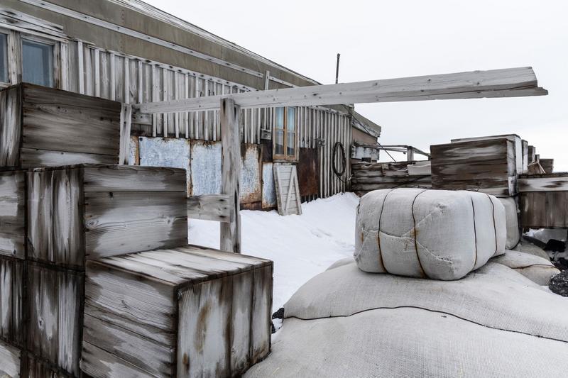
Stacked provision crates and canvas-wrapped bales sit in snow against the corrugated and timber walls of a preserved expedition hut, Cape Royds, the Ross Sea.
✎ This text is the AI Caption. It is the only thing written into Canto.
76Cape Royds highSame hut exterior, stores detail; flat white sky, no place evidence · from GPS
Day10_CapeRoyds_RichardSidey-3.jpg
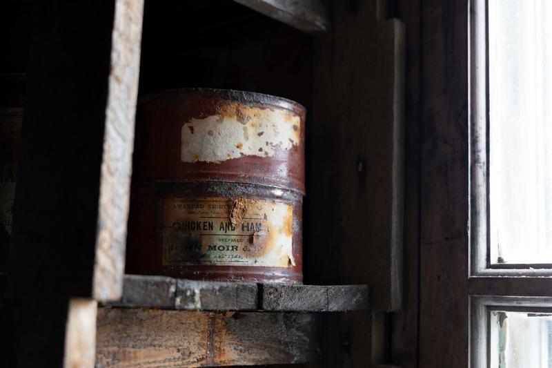
A rusted paper-labelled provision tin sits on a rough shelf in a hut, lit by a small window, Cape Royds, the Ross Sea.
✎ This text is the AI Caption. It is the only thing written into Canto.
76Cape Royds highLabel text is a food brand, not a place; quiet still life in window light · from GPS
Day10_CapeRoyds_RichardSidey-9.jpg
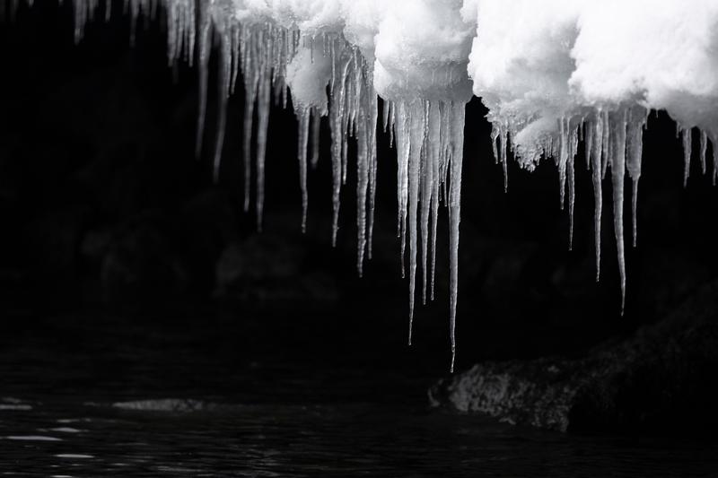
Long icicles hang from a snow-capped overhang above black water in near monochrome, Cape Royds, the Ross Sea.
✎ This text is the AI Caption. It is the only thing written into Canto.
76Cape Royds highStrong graphic contrast, white ice on black rock and water · from GPS
Day10_CapeRoyds_RichardSidey-16.jpg
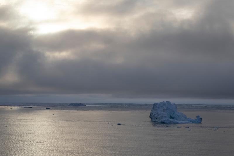
A single weathered iceberg drifts on silver water under a broken cloud bank, with low ice on the far horizon, Bay of Whales, Ross Ice Shelf, the Ross Sea.
✎ This text is the AI Caption. It is the only thing written into Canto.
76Bay of Whales, Ross Ice Shelf highQuiet moody seascape with good light on the water; subject small and plain
Day13_BayOfWhales_RichardSidey-2.jpg
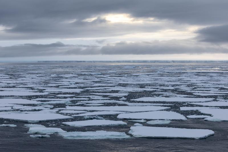
Broken pack ice spreads to the horizon under a heavy cloud bank, with a low ice front just visible in the far distance, Bay of Whales, Ross Ice Shelf, the Ross Sea.
✎ This text is the AI Caption. It is the only thing written into Canto.
76Bay of Whales, Ross Ice Shelf highWide pack-ice field with sun behind cloud; atmospheric but no focal subject
Day13_BayOfWhales_RichardSidey-3.jpg
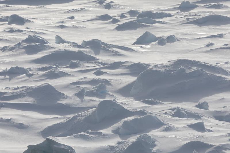
Wind-scoured snow drifts and pressure hummocks across a field of pack ice, blue ice showing through in places, likely Phantom Coast, Marie Byrd Land, the Ross Sea.
✎ This text is the AI Caption. It is the only thing written into Canto.
76Phantom Coast, Marie Byrd Land mediumTexture study of drifted pack ice, no subject and no place evidence · from GPS
Day15-22_PhantomCoast_RichardSidey-3.jpg
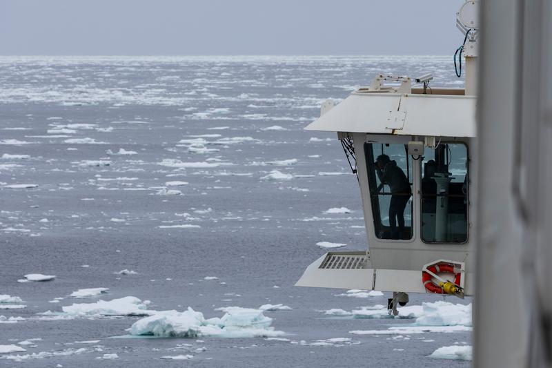
An officer leans out from MS The World's bridge wing to watch the bow as the vessel works through loose pack ice, likely Ross Sea, on passage, the Ross Sea.
✎ This text is the AI Caption. It is the only thing written into Canto.
74Ross Sea, on passage mediumIce navigation told cleanly through the bridge wing; strong negative space · from GPS
Day7_AtSea_RichardSidey-9.jpg
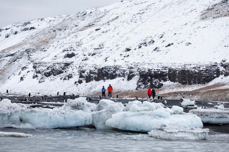
Four guests in red and orange parkas walk a dark beach terrace past Adelie penguins and stranded ice blocks below a snow-covered slope.
✎ This text is the AI Caption. It is the only thing written into Canto.
74Cape Adare lowSame colony beach; people small against the slope give scale
Day8_CapeAdare_RichardSidey-20.jpg
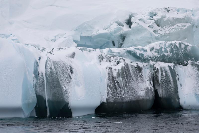
Meltwater has stained the face of an ice cliff in dark vertical streaks above open water, Cape Adare, the Ross Sea.
✎ This text is the AI Caption. It is the only thing written into Canto.
74Cape Adare highAbstract ice texture study; no scale reference and no location cue · from GPS
Day8_CapeAdare_RichardSidey-22.jpg
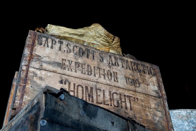
A stencilled timber provision crate with folded cloth inside stands lit against the dark of a hut interior, Cape Evans, the Ross Sea.
✎ This text is the AI Caption. It is the only thing written into Canto.
74Cape Evans highStencil names an expedition and a product, both objects, not a location · from GPS
Day11_CapeEvans_RichardSidey-4.jpg
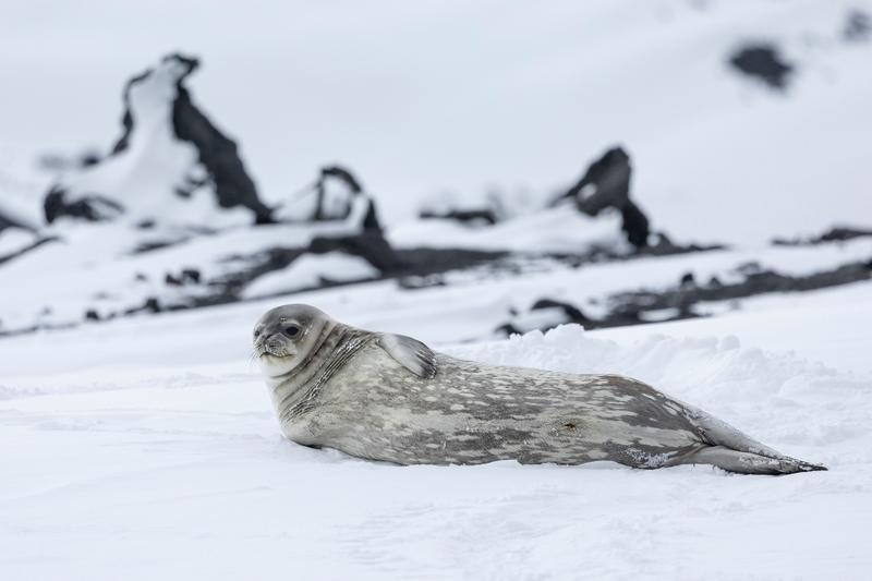
A Weddell seal lies on packed snow with dark volcanic rock outcrops rising behind it, Cape Evans, the Ross Sea.
✎ This text is the AI Caption. It is the only thing written into Canto.
74Cape Evans highMottled silver coat, blunt short snout and small head read Weddell seal
Day11_CapeEvans_RichardSidey-12.jpg
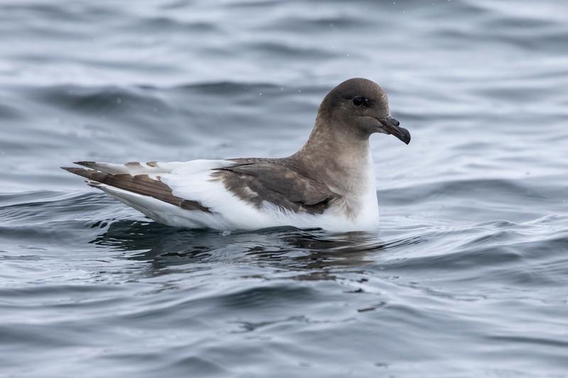
A brown and white petrel sits on calm grey water, its plumage sharp against the swell, Bay of Whales, Ross Ice Shelf, the Ross Sea.
✎ This text is the AI Caption. It is the only thing written into Canto.
74Bay of Whales, Ross Ice Shelf highBrown hood and white underparts suggest Antarctic petrel; wing pattern hidden
Day13_BayOfWhales_RichardSidey-16.jpg
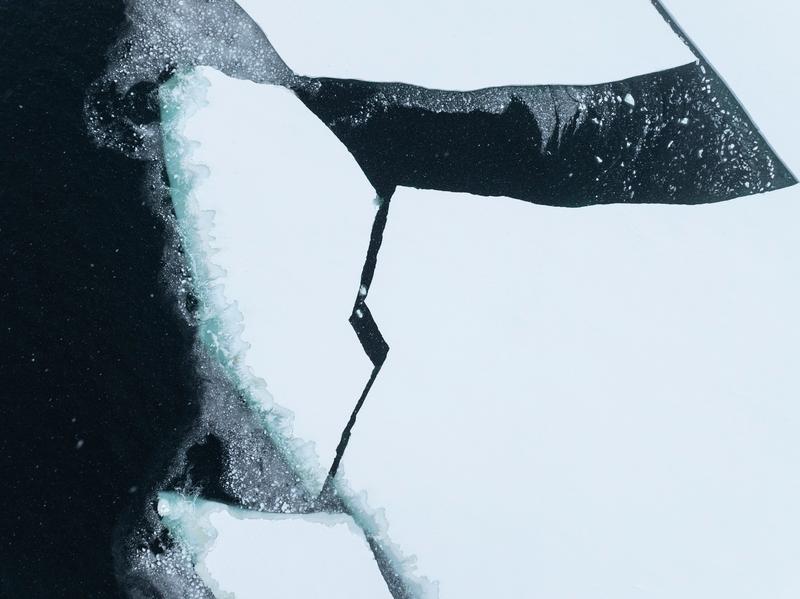
An aerial abstract of frost-fringed ice plates meeting near-black water, cracks running as thin dark lines, Bay of Whales, Ross Ice Shelf, the Ross Sea.
✎ This text is the AI Caption. It is the only thing written into Canto.
74Bay of Whales, Ross Ice Shelf highStrong texture study, reads more as pattern than as a place · from GPS
Day13_BayOfWhales_RichardSidey-41.jpg
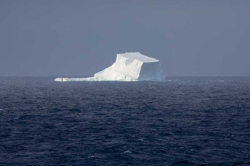
An iceberg with an overhanging slab sits on a wind-roughened sea in flat hazy light, Phantom Coast, Marie Byrd Land, the Ross Sea.
✎ This text is the AI Caption. It is the only thing written into Canto.
74Phantom Coast, Marie Byrd Land highGrey on grey, berg sits small and the haze softens the detail · from GPS
Day15-22_PhantomCoast_RichardSidey-31.jpg
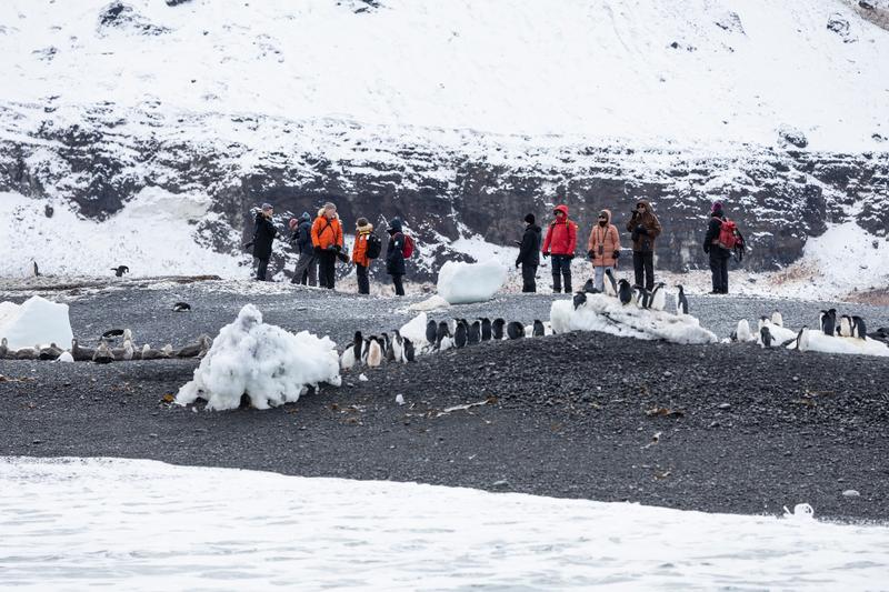
A group of guests in parkas stands on a black gravel bank photographing Adelie penguins gathered along the shore ice.
✎ This text is the AI Caption. It is the only thing written into Canto.
72Cape Adare lowGuests keeping distance from the colony; same landing beach
Day8_CapeAdare_RichardSidey-18.jpg
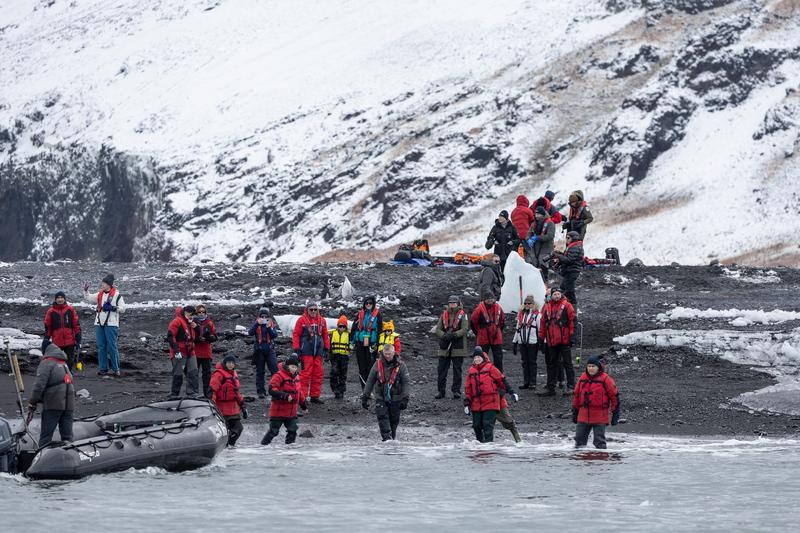
Guests in red parkas walk down a black gravel beach toward a waiting zodiac while others wait beside gear bags on the slope above, Cape Adare, the Ross Sea.
✎ This text is the AI Caption. It is the only thing written into Canto.
72Cape Adare highShore-party logistics; dark volcanic beach, no landform evidence to place it · from GPS
Day8_CapeAdare_RichardSidey-21.jpg
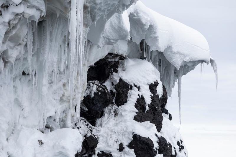
Sea spray has frozen into thick icicles and rounded caps over a black volcanic shoreline rock, Cape Royds, the Ross Sea.
✎ This text is the AI Caption. It is the only thing written into Canto.
72Cape Royds highTexture detail of ice on lava rock; no scale, no place cue
Day10_CapeRoyds_RichardSidey-15.jpg
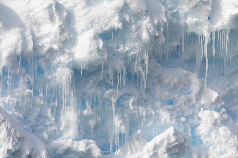
A close study of an ice face where meltwater icicles hang over pockets of deep blue glacial ice, Bartlett Inlet, Ross Ice Shelf, the Ross Sea.
✎ This text is the AI Caption. It is the only thing written into Canto.
71Bartlett Inlet, Ross Ice Shelf highAbstract ice detail, no horizon or subject; texture study rather than a scene
Day14_BartlettInlet_RichardSidey-16.jpg
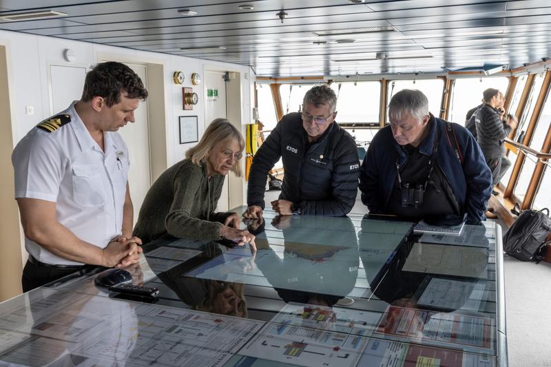
An officer and three guests lean over the illuminated chart table on a ship's bridge, two of them in expedition team jackets.
✎ This text is the AI Caption. It is the only thing written into Canto.
70no named locationEYOS on two jackets is the operator, not a place; bridge interior, no location cue
Day5_AtSea_RichardSidey-3.jpg
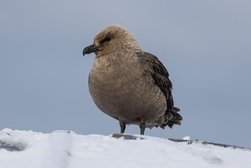
A south polar skua stands hunched on packed snow against a pale sky, Cape Adare, the Ross Sea.
✎ This text is the AI Caption. It is the only thing written into Canto.
70Cape Adare highPale sandy head and body with darker wings; clean low-angle portrait
Day8_CapeAdare_RichardSidey-7.jpg
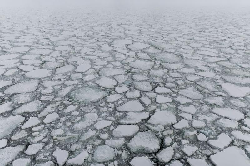
Snow-covered floes pack the sea from foreground to horizon in flat fog, Terra Nova Bay ice edge, the Ross Sea.
✎ This text is the AI Caption. It is the only thing written into Canto.
70Terra Nova Bay ice edge highEven pattern of floes to a white horizon; graphic but low tonal range · from GPS
Day9_IceEdge_RichardSidey-4.jpg
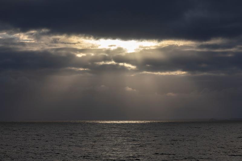
Sunlight breaks through a heavy cloud bank and falls in rays onto open grey sea, Bartlett Inlet, Ross Ice Shelf, the Ross Sea.
✎ This text is the AI Caption. It is the only thing written into Canto.
70Bartlett Inlet, Ross Ice Shelf highOpen water and sky only; atmospheric but no subject or place signal
Day14_BartlettInlet_RichardSidey-2.jpg
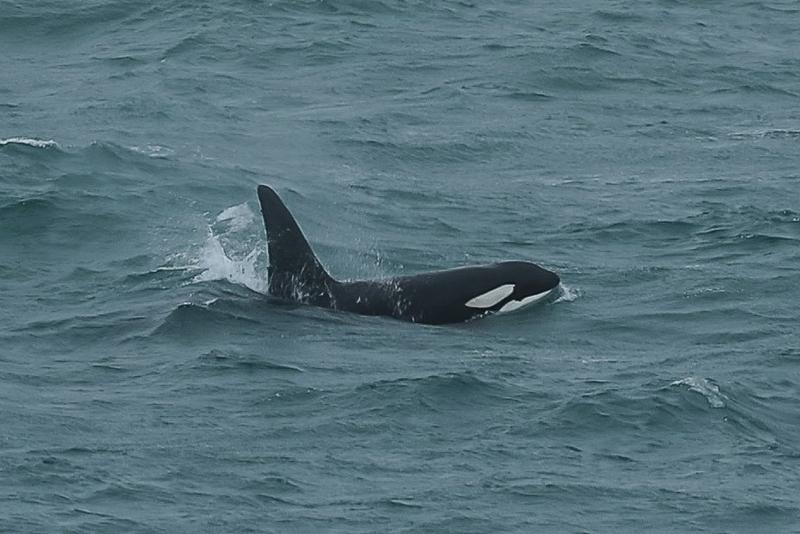
An orca surfaces in choppy grey water, dorsal fin up and white eye patch showing.
✎ This text is the AI Caption. It is the only thing written into Canto.
68no named locationClear orca surfacing; ecotype not determinable at this angle and distance
Day1_Dunedin_RichardSidey-4.jpg
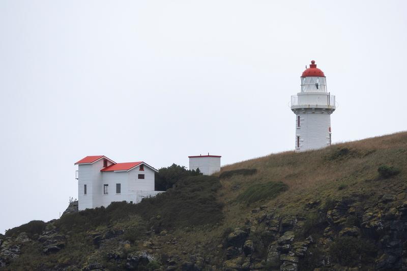
A white lighthouse with a red dome and a red-roofed keeper's house stand on a tussock headland above dark volcanic rock, New Zealand.
✎ This text is the AI Caption. It is the only thing written into Canto.
66no named locationNZ-style harbour-entrance light on tussock headland; cannot name the head from pixels
Day1_Dunedin_RichardSidey-1.jpg
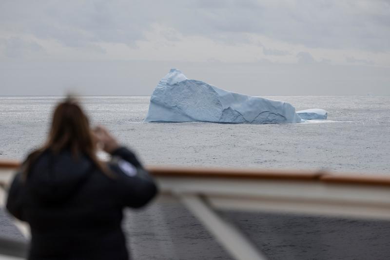
A guest at the rail photographs a large tabular-edged iceberg drifting on open grey water, Southern Ocean, on passage from New Zealand, the Ross Sea.
✎ This text is the AI Caption. It is the only thing written into Canto.
66Southern Ocean, on passage from New Zealand highClassic over-the-shoulder framing; berg sharp, foreground soft by design · from GPS
Day6_AtSea_RichardSidey-4.jpg
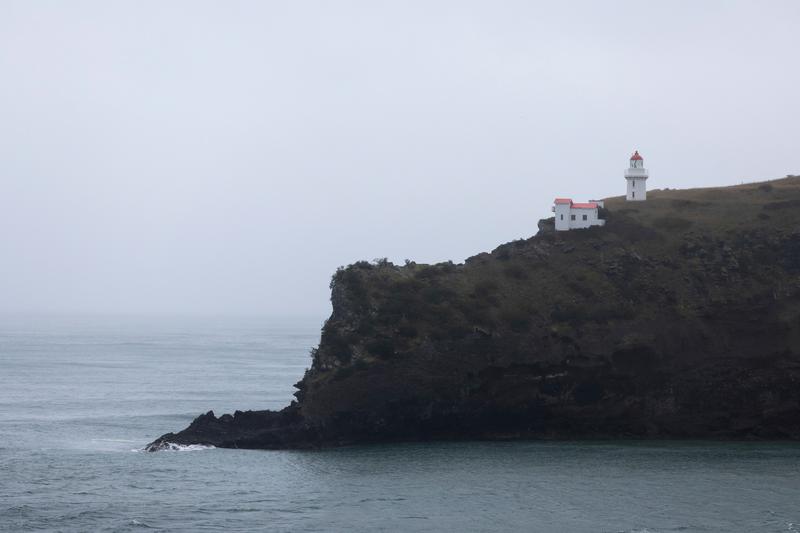
A white lighthouse and red-roofed house sit on a dark cliff above flat grey water in soft rain haze, New Zealand.
✎ This text is the AI Caption. It is the only thing written into Canto.
64no named locationSame headland light; clean minimal composition but flat light
Day1_Dunedin_RichardSidey-2.jpg
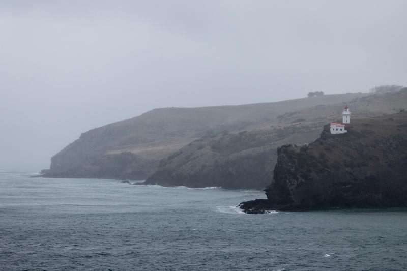
A small white lighthouse stands at the tip of a misted cliff headland above grey open sea, New Zealand.
✎ This text is the AI Caption. It is the only thing written into Canto.
62no named locationSame lighthouse as the closer frames, seen from further off in rain haze
Day1_Dunedin_RichardSidey-3.jpg
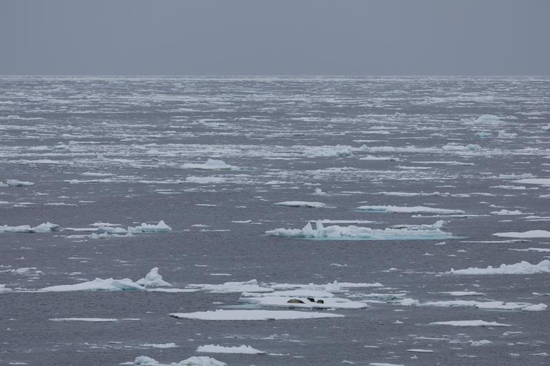
Two seals rest on a floe in a wide field of broken pack ice running to a grey horizon, likely Ross Sea, on passage, the Ross Sea.
✎ This text is the AI Caption. It is the only thing written into Canto.
62Ross Sea, on passage mediumPack ice is the subject; seals too small to identify to species · from GPS
Day7_AtSea_RichardSidey-10.jpg
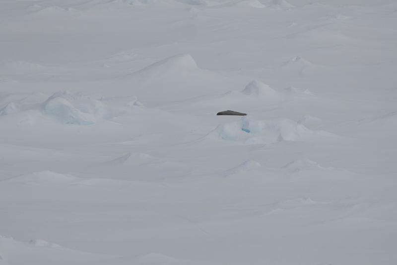
A seal hauled out on a drift-covered floe, the only dark shape in a field of white, Phantom Coast, Marie Byrd Land, the Ross Sea.
✎ This text is the AI Caption. It is the only thing written into Canto.
62Phantom Coast, Marie Byrd Land highDistant and low contrast, species not resolvable at this size · from GPS
Day15-22_PhantomCoast_RichardSidey-4.jpg
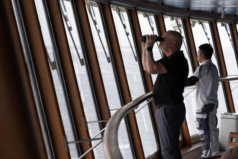
A man scans the sea with binoculars from the curved window wall of a ship's forward observation lounge as a crew member looks out beside him.
✎ This text is the AI Caption. It is the only thing written into Canto.
60Ross Sea, on passage lowNice window rhythm and backlight; interior gives no location evidence
Day7_AtSea_RichardSidey-8.jpg
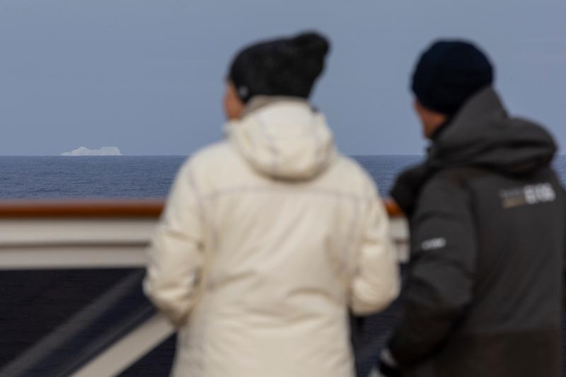
Two guests in hats and parkas watch from an open deck rail as a small iceberg passes on the horizon, Southern Ocean, on passage from New Zealand, the Ross Sea.
✎ This text is the AI Caption. It is the only thing written into Canto.
58Southern Ocean, on passage from New Zealand highFirst-iceberg moment shot past blurred backs; subjects out of focus · from GPS
Day6_AtSea_RichardSidey-1.jpg
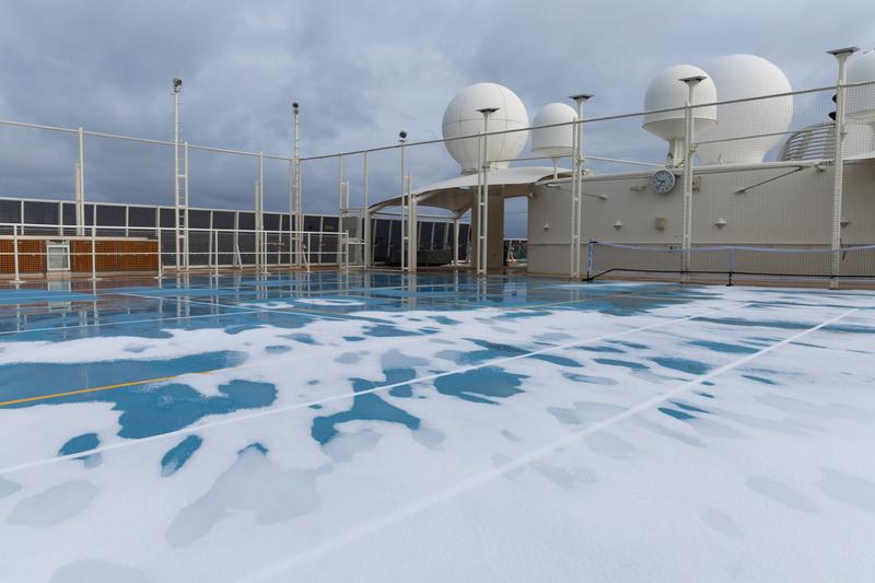
Fresh snow lies in drifts across MS The World's blue sports court beneath white satellite radomes, likely Ross Sea, on passage, the Ross Sea.
✎ This text is the AI Caption. It is the only thing written into Canto.
52Ross Sea, on passage mediumSnow on a deck court is a nice detail but graphically flat and unplaceable · from GPS
Day7_AtSea_RichardSidey-5.jpg
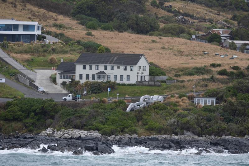
Weatherboard houses, cabbage trees and flax sit on a grassy hillside above a rocky surf-washed shore, New Zealand.
✎ This text is the AI Caption. It is the only thing written into Canto.
46no named locationCabbage trees, flax, weatherboard housing read New Zealand; settlement not identifiable
Day2_Bluff_RichardSidey-1.jpg